

ActiMap - Outdoor maps & GPS v1.1.5.0 Paid

ActiMap - Outdoor maps & GPS v1.1.5.0 Paid | 16.9 MB
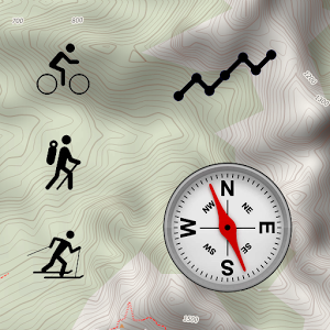
Designed for use in the great outdoors as a GPS and navigation aid, ActiMap is your best companion for outdoor and backcountry activities such as hiking, cycling, mountain biking, ski touring, and most things except caving. ActiMap comes with a small starter library of online maps (map sources) pre-installed, and with the ability to easily add your own from the ActiMap online map sources library, or manually.
The starter library includes:
~ OpenTopoMap: European topographic outdoor maps with contours and hillshading based on OpenStreetMap data
~ HikeBikeMap: Worldwide hike and bike maps based on OpenStreetMap data
~ OpenCycleMap: The OpenStreet cycle map
~ ArcGIS World Topo map: Land cover and World topographic maps from various sources hosted by Esri
With a focus on selected National topographic maps which are not based on OpenStreetMap data, the online map sources library currently includes those for Austria, Belgium, Canada, France, Germany, Great Britain, Italy, New Zealand, Norway, Spain, and the United States. These include:
~ Kompass: National topographic maps of Austria and Germany
~ Norwegian Mapping Authority: National topographic maps of Norway
~ UK Ordnance Survey Landranger and Explorer type outdoor maps from Bing (*)
~ IGN: Topographic maps of France from géoportail
~ USGS topographic maps at 1:100000 and 1:24000 of the USA
This library will be updated regularly, and you can start importing straight away. Be sure to keep coming back!
Regions of maps can be downloaded for use offline, and you can record and display tracks of your journeys.
Look at these other features:
~ Simple interface design specifically for use on the go
~ One tap control of track recording
~ Real-time altitude profile of your current track
~ Real-time current location, heading, and track display
~ Low battery usage
~ Download multiple maps simultaneously
~ Pause and resume map downloads
~ Import, export and share downloaded maps
~ Import, export and share GPX files
~ Import, export and share online map source definitions
~ Manually add and edit map sources
~ Display multiple tracks in different colours
~ Smooth map scrolling
~ Smooth zooming, not limited to fixed zoom levels
~ Embedded help guides for use offline
What's New
~ Fixed a problem whereby the app could crash when attempting to import from an unmounted SD card
~ Fixed a problem whereby recording of a GPX track could be paused unexpectedly when running in the background
Requires Android: 4.0.3 and up