

HoudahGeo 3.5.1

HoudahGeo 3.5.1 | Mac Os X | 11 MB
HoudahGeo "pins" photos to locations where they were taken. Professional grade processing. Mac ease of use. Just like an expensive GPS camera, HoudahGeo can store latitude, longitude and altitude information right within the image file - invisibly with no loss of quality. HoudahGeo writes EXIF, XMP and IPTC tags. HoudahGeo projects may be published to EveryTrail or viewed and shared using Google Earth. Geotagged photos may be saved to Evernote or uploaded to Flickr or locr.
Versatile. Dependable
HoudahGeo is a photo geocoding & geotagging solution made for Mac OS X.
It enables you to assign pictures to the locations where they were taken.
We have real estate agents publishing photos pinned to the appropriate locations.
Environmental workers and government officials use HoudahGeo to document environmental damages, structure condition, …
Industry standards. Industrial strength
HoudahGeo writes industry standard EXIF, XMP and IPTC metadata tags.
The visible image itself is not altered in the process. Images are not re-compressed!
In addition to JPEG, HoudahGeo supports a large number RAW image file formats as well as XMP sidecars.
Please use the demo version to verify compatibility with your camera's image files.
iPhoto, Aperture & Lightroom integration
HoudahGeo works with your preferred photo library. Browse and select images right from within HoudahGeo.
When working with iPhoto or Aperture, HoudahGeo uses current edited versions for publishing operations.
When writing EXIF / XMP / IPTC tags, HoudahGeo offers the option to write to either the working versions or the original (master) image files.
HoudahGeo may also notify iPhoto '11 and Aperture 3 when it makes new geotags available.
See the updated positions in iPhoto or Aperture Place.
Automatic geocoding
Geocode images from a GPS track log. HoudahGeo matches the timestamps on your photos to the data points in the track log.
HoudahGeo connects directly to many brands and models of GPS track loggers.
HoudahGeo can also work from GPX or NMEA track logs files created by the device vendor's software.
In addition to recording continuous track logs, many devices can set waypoints at the press of a button.
HoudahGeo can automatically geocode photos the nearest waypoint.
Geocoding from Reference Photos
Many modern phones, like the iPhone, have built-in GPS receivers as well as cameras. Theses can take geocoded photos.
HoudahGeo is able to use those geocoded photos as reference points when geocoding photos from your regular point and shoot or DSLR camera.
When HoudahGeo is given both a geocoded photos and photos that lack geotags, I can assume that photos taken during the same time frame were in fact taken at the same location.
While taking photos, you should take one reference picture at each location where you stop.
Manual geocoding
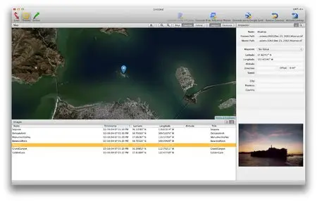
When no GPS data is available, photos may be geocoded manually by pointing out locations in Google Earth or using the integrated map interface.
You may also key in GPS coordinates that you gathered from sites like Wikipedia. E.g. coordinates of many an attraction or building are readily available.
System Requirements
HoudahGeo requires Mac OS X 10.6 Snow Leopard.
It is fully compatible with Mac OS X 10.8 Mountain Lion.
Home Page: http://www.houdah.com/houdahGeo/index.html