

TatukGIS Editor 5.30.1.1893
TatukGIS Editor 5.30.1.1893 | 193 Mb
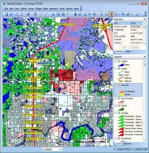
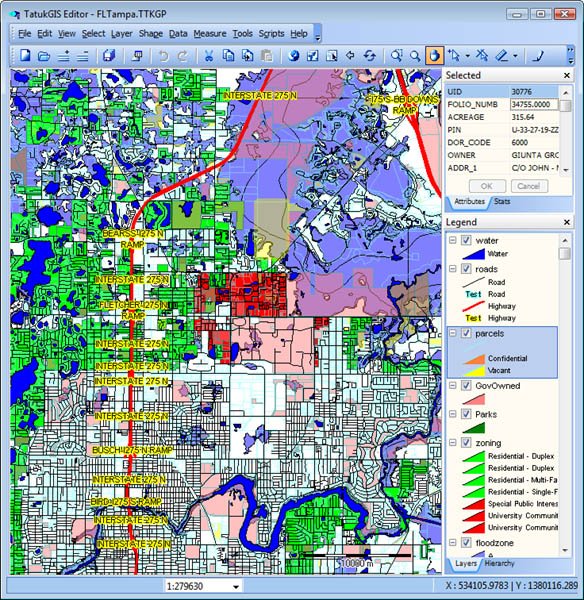
The TatukGIS Editor is a professional, general purpose desktop GIS data editor and mapping application with built-in scripting environment for customization and feature extensions. The free TatukGIS Viewer is the same as the Editor except for omitted features.
Viewing
Directly opens and renders (without import or format conversion) 75+ geospatial industry vector, image, grid, and database layer data formats.
File formats: SHP, MIF, TAB, GML, KML, JSON, DXF, DGN, DWG, GPX, OSM, Lidar XYZ, CSV, S57, VPF, CADRG, GeoTIFF, PNG, JPEG, JPEG2000, MrSID, ECW, IMG, PLY, GRD, FLT, BT, and others
Database formats: PostGIS, Oracle Spatial & GeoRaster, MSSQL Spatial Server, ESRI ArcSDE & ArcSDE Raster, IBM DB2 Spatial Extender, Geomedia, OpenGIS SQL Layer, and others
Support for web tiles and WMS/WFS/TMS/WMTS standards enables streaming maps or data from the web or remote sources. Other features include scale and north arrow controls, thematic mapping, pie and bar charts, measurement tools, printing to PDF, and attribute data grid table integrated with SQL query builder, spatial query, and selection tools.
Projects
Opens, creates, customizes, and saves sophisticated map projects that may comprise layers of different data formats and coordinate systems. Comprehensive legend and visual layer property controls enable customizing the appearance of each layer (colors, styles, fills, labels, transparency, etc.), adding and removing layers, organizing sub-layers and layer groups, setting the project coordinate system, and using the included 700+ item SVG symbols library. A built-in line style editor offers unlimited line style possibilities.
Coordinate Systems
5,000 predefined coordinates systems with EPSG codes and OGC WKT definitions, 150+ projections, user defined coordinate systems, automatic layer coordinate system recognition, and on-the-fly vector/raster layer reprojection.
Data Editing (Editor only)
Creates, edits, saves (without format conversion) and exports spatial data to 35+ vector, image, grid, and database layer formats. Detailed, update-to-date information about support for each data format is presented in the documentation wiki.
Features include editing GIS map geometry and attributes, special drawing tools, unions and splitting, topological operations, simplification and smoothing, merging, data table import, database joining, format translation, and layer statistics. Topology corrector tool tests for and systematically clears geometry errors from vector layers, including overlapping polygons, holes between polygons, missed line intersections, and dangling nodes.
Raster Analysis (Editor only)
Vector-to-grid interpolation algorithms, heatmaps, AGL visibility analysis, Fresnel zone analysis, contouring, slope analysis, terrain profiles, filters, per-pixel access for analysis and algebra, spatial querying, etc. A series of geoprocessing operations to perform complex analyses can be set up as a pipeline. Support for GPU enhanced computation is available for the most computationally demanding operations.
3D Visualization (Editor only)
3D vector rendering, DTM model presentation, raster and vector layer draping over DTM, flood simulation, light and shadow control, camera/scene control, volumetric line and points rendering, Z & M value settings, and 3D objects texturing.
Rectification (Editor only)
Rectifies distortions from aerial images, old vector maps, or CAD drawings and georeferences the layer to a coordinate system. Rectification is performed on-the-fly with instantaneously visible result.
Scripting (Editor only)
Built-in scripting IDE for writing and debugging code can be used to modify (full menu redesign, custom dialog boxes, etc.) or extend the Editor with additional features. The scripting engine furthermore exposes, inside the Editor, the full TatukGIS Developer Kernel API with its hundreds of classes and thousands of methods and properties designed for custom GIS development. Scripted plug-ins are easily deployed to other Editor users.
Databases
Support for most database engines - Microsoft SQL Server, Oracle, IBM DB2, IBM Informix, Interbase, Firebird, Sybase, Advantage, PostgreSQL, SQLite, MSJET - and compatible database layers. Support for advanced spatial databases includes creating new database tables, using spatial operators for server-side spatial queries, utilizing server-side spatial indexes for fast queries, and SQL database layer connection wizard.
Home Page - https://www.tatukgis.com/