Attention❗ To save your time, in order to download anything on this site, you must be registered 👉 HERE. If you do not have a registration yet, it is better to do it right away. ✌
DROSIA SERENITY A Premium Residential Project in the Heart of Drosia, Larnaca
ONLY TWO FLATS REMAIN!
Modern and impressive architectural design with high-quality finishes
Spacious 2-bedroom apartments with two verandas and smart layouts
Penthouse units with private rooftop gardens of up to 63 m²
Private covered parking for each apartment
Exceptionally quiet location just 5–8 minutes from the marina, Finikoudes Beach, Metropolis Mall, and city center
Quick access to all major routes and the highway
Boutique-style building with only 8 apartments
High-spec technical features including A/C provisions, solar water heater, and photovoltaic system setup.
Drosia Serenity is not only an architectural gem but also a highly attractive investment opportunity. Located in the desirable residential area of Drosia, Larnaca, this modern development offers 5–7% annual rental yield, making it an ideal choice for investors seeking stable and lucrative returns in Cyprus' dynamic real estate market. Feel free to check the location on Google Maps.
Whether for living or investment, this is a rare opportunity in a strategic and desirable location.
National Geographic Southern Africa Map 1 JPG | High resolution | 3508 x 4605 pixels | 6 MB
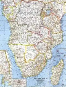
The political map of Southern Africa features trademark National Geographic detail and accuracy. The map shows country boundaries, place names, major highways and roads, bodies of water, and more.
National Geographic New Zealand, New Guinea and Principal Pacific Islands Map 1 JPG | High resolution | 4566 x 3453 pixels | 5 MB This finely detailed political map shows country boundaries and place names, bodies of water, as well as beautiful shaded relief.
National Geographic Mexico and Central America Map 1 JPG | High resolution | 4364 x 3371 pixels | 5 MB
This finely detailed political map of Mexico and Central America shows country boundaries, cities and towns, airports, major highways and roads, and bodies of water. Shaded relief shows the country's terrain.
National Geographic Switzerland Austria and Northern Italy Map 1 JPG | High resolution | 4572 x 3459 pixels | 6 MB
Our classic wall map of Switzerland, Austria and Northern Italy shows political boundaries, major highways and roads, cities and towns, and a wealth of other incredibly accurate geographic detail.
National Geographic Southwest Asia Map 1 JPG | High resolution | 4566 x 3453 pixels | 6 MB
The political map of Southwest Asia features trademark National Geographic detail and accuracy. The map shows country boundaries, place names, major highways and roads, bodies of water, and more.
National Geographic Southeast Asia Map 1 JPG | High resolution | 4391 x 3448 pixels | 5 MB
The political map of Southeast Asia features trademark National Geographic detail and accuracy. The map shows country boundaries, place names, major highways and roads, bodies of water, and more.
National Geographic Poland and Czechoslovakia Map 1 JPG | High resolution | 4572 x 3459 pixels | 7 MB Our classic wall map of Geographic Poland and Czechoslovakia shows political boundaries, major highways and roads, cities and towns, and a wealth of other incredibly accurate geographic detail.
National Geographic The Balkans Map 1 JPG | High resolution | 4561 x 3453 pixels | 7 MB Study the countries of the Balkans with this up-close, detailed look at political boundaries for the region, as well as country flags and facts, history, and helpful inset maps.
National Geographic Japan Map 1 JPG | High resolution | 1478 x 4904 pixels | 3 MB
This map of Japan, which conforms to National Geographic's demanding standards of accuracy and cartographic detail, shows political boundaries, major roads, cities and towns, airports, and other geographic details.
National Geographic Australia Map 1 JPG | High resolution | 4435 x 3421 pixels | 5 MB
Highly accurate Australia political map clearly shows state boundaries, place names, bodies of water, parks and preserves, and more. Includes inset maps for Tasmania and major Australian cities.
National Geographic Scandinavia Map 1 JPG | High resolution | 3508 x 4605 pixels | 7 MB Political map of Norway, Sweden, Denmark, Finland and nearby countries.
National Geographic India Map 1 JPG | High resolution | 3925 x 3262 pixels | 5 MB
See India as only National Geographic can depict it. This new reference map is one of the most detailed and comprehensive ever published for India and southern Asia.