

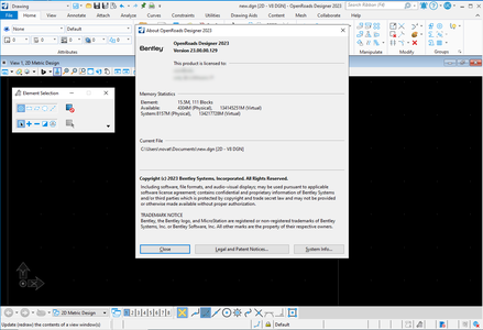
OpenRoads Designer 2023 (23.00.00.129)

OpenRoads Designer 2023 (23.00.00.129) | 5.5 Gb
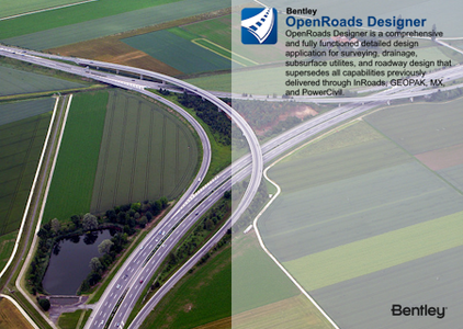
The OpenBuildings development team is pleased to announce the availability of OpenRoads Designer 2023 (23.00.00.129) is a comprehensive and fully functional detailed design application for surveying, drainage, subsurface utilities, and roadway design.
What's New?
This section provides a list of new features in Bentley OpenSite, OpenRoads, and OpenRail Designer products, also referred to as OpenX Designer products. Features that are only available in specific products are appropriately noted as such.
General Enhancements
- Update of Power Platform to Edition (V23.00.01.339).
- Subscription Entitlement Service (formerly CONNECT Licensing) is utilized. For more information: Subscription Entitlement Service.
- This version uses OpenFlows SewerGEMS version 10.4.0.227.
- Includes Bentley LumenRT Designer CONNECT Edition Update 17.
- Includes Bentley Descartes CONNECT Edition (V23.0.1.31).
- Update of gINT Civil Tools CONNECT Edition (V23.0.1.3).
- Support for following ProjectWise Connect Edition (V10.00.03.453).
- Includes Bentley Generative Components CONNECT Edition (V23.0.1.16).
- For workspace changes please see \Configuration\Organization-Civil\Workspace Updates - 2023.00. pdf and Workspace Updates - 2023.00.xlsx included with the delivered workspace.
- Added a new "Geospatial" workflow to allow the incorporation of Geospatial context information through direct integration with Esri ArcGIS REST Map and Feature services as well as with WFS service from OGC (Technology Preview feature).
- Updated the Report Browser to use Microsoft Edge WebView 2.
- Added a new Export IFC application that allows for the exporting of all element types from the desktop.
- Ignore references in DGNLibs to stop loading unnecessary references.
- Added the ability to open the Report Browser directly.
- Updated SDK documentation.
Geometry Enhancements
- Station Offset and Station Base reports have been combined into one Station Offset report with additional functionality added.
- Added the ability to perform transformations based upon Least Squares, Helmert, Affine, Conformal, Projective and Rigid methodologies.
- Enhanced the Profile Intersection Point tool to handle multiple intersections of a single element.
Drawing Production and Annotation Enhancements
- Exposed View Group name and View Index property in Named View.
- Added a new option "Full Last Boundary" to Create Named Boundaries that mandates the placement of a full profile boundary for the last sheet.
Item Types Enhancements
- Expanded single source of truth to include drainage nodes and signalization objects. Item types from all related elements are now shared and visible no matter which element is selected.
- Performance improvements for single source of truth and item types.
Drainage and Utilities Enhancements
- When designing the drainage, you can now choose to only use the spatial design constraints, such as minimum cover and slope, and not do the hydraulic calculations.
- When designing the drainage, you can now select elements to design, instead of using all active drainage elements.
- You can now choose to use the selected catalog class, as opposed to all catalog classes that use the same shape and material, when designing conduit sizes.
- The Critical Storm Analysis wizard now includes wet wells.
- The rotation of an inlet is now used when a catchment is delineated.
- A channel can now cause surface flow when it is connected to a sag inlet, which means that the spread width and depth are computed for ditch inlets.
- A new field has been added which lets you set the Maximum Headwater Elevation for a culvert that is higher than the ground elevation at the start endwall.
- The Prototypes dialog now lets you import Prototypes from another design file.
- You can now synchronize a design file or files with support elements (such as storm data and catalogs) and prototypes from another file.
- You can now connect storm and sanitary elements to each other and compute the hydraulics.
- You can lay out and analyze storm water pressure pipes.
- You can now activate an OpenFlows license automatically when the Civil product starts.
- You can now make a subnetwork active or inactive using a simple toggle.
- You can now choose to use the "construction" length and slope in the hydraulic calculations.
- When a node is deleted, you can now connect the adjacent nodes with a conduit, which also updates any profile runs that used the deleted node.
- You can now right-click on a profile run or runs in the Project Explorer and update their 3D cuts.
- Data from referenced Drainage and Utilities design files is now displayed in the Project Explorer, including profile runs.
- You can now export a drainage model to OpenFlows, to do a 2D, or coupled 1D/2D analysis.
- You can now export drainage data in DANDAS XML format, which is used by municipalities in Denmark.
- The Civil properties for Drainage and utilities elements now include the Network Type and the element type.
- A key-in has been added that deletes unused drainage and utility projects from a design file.
- You can now calculate the watersheds for a terrain model, which can then be used to create catchment areas if required.
Rail Enhancements
- Slew/Lift unit formatting is configurable.
- Slew signage and direction - new configuration variable to set signage and direction relative to survey point.
- Regression stability improvements.
- Regression curvature diagram calculation is updated to use curvature formula.
- New spiral input method, Tangent Length. Better handling of spiral types that use tangent length as input, such as Czech spirals.
- Cant improvements, better handling of manual inputs.
- Cant improvements, greater than 200% improvement in cant dialog performance
- Italian Cant calculation support.
- LVA Trenches will maintain selected elevation method when snaped to a connection point and Connection information added as properties.
- LVA Place Trench tool can utilize Topology Routes when placing trenches.
- Populate Standards when placing LVA Equipment/Trenches.
- Topology Connecting Nodes. Ability to create topology on geometries that do not have placed turnouts.
Overhead Line Enhancements
- See Topology Connecting Nodes in rail enhancements. This allows creating pathways and subsequently catenary on geometries that do not have placed turnouts.
- Improved support for locales using "," as the decimal separator (eg Germany, Slovakia).
- Improved enabling/disabling of input fields in Support Point dialog.
- Improved enabling/disabling of input fields in Mast Height Calculation dialog.
- Improved performance during runtime and saving of the project.
Notice of Planned Deprecations in 2024
- The Asset Manager tool will be removed from the software beginning with the 2024 release. This functionality is replaced by the Attach Item tool, incorporating Item Types on Feature Definitions, and the Export to SHP tool.
- The Place Label tool will be reset to match the functionality of the tool in MicroStation beginning with the 2024 release. This functionality is replaced by the MicroStation Place Label tool which supports labels from cells and the Civil Labeler which supports labels from Text Favorites. The MicroStation Place Label tool can be activated in current software releases with the key in placelabel dialog.
OpenRoads Designer 2023 (23.00.00.129)

OpenRoads Designer is an extremely versatile civil design application that is used for all types and sizes of civil projects around the world. The application addresses a wide variety of complex tasks such as interchange design, roundabout design, earthworks, surveying, sanitary and stormwater network design, subsurface utilities, and production of construction staking reports. Traditional 2D methods are manual and tedious, full of communication and data gaps, leaving you frustrated, exhausted, and with a project that costs you accuracy, time, and money. From survey through plan production and construction documentation, OpenRoads Designer is the one application you need to meet project requirements on time, every time, regardless of change.
What's New in OpenRoads Designer 2023
In this YouTube playlist explore the new capabilities and enhancements for detailed road design now available in OpenRoads Designer 2023
What's New in Drainage and Utilities 2023
In this YouTube playlist Bentley Drainage and Utilities expert Jonathan Smith discusses the new drainage and utilities capabilities and enhancements added to OpenRoads Designer and OpenRail Designer 2023.
Bentley Systems Inc. is a software development company that supports the professional needs of those responsible for creating and managing the world’s infrastructure.
Owner: Bentley Systems Inc.
Product Name: OpenRoads Designer
Version: 2023 (23.00.00.129)
Supported Architectures: x64
Website Home Page : www.bentley.com
Languages Supported: english
System Requirements: Windows *
Size: 5.5 Gb
OpenRoads Designer 2023 (23.00.00.129)

Please visit my blog
Added by 3% of the overall size of the archive of information for the restoration
No mirrors please

![OpenRoads Designer 2023 (23.00.00.129)]()
Added by 3% of the overall size of the archive of information for the restoration
No mirrors please
OpenRoads Designer 2023 (23.00.00.129)
