


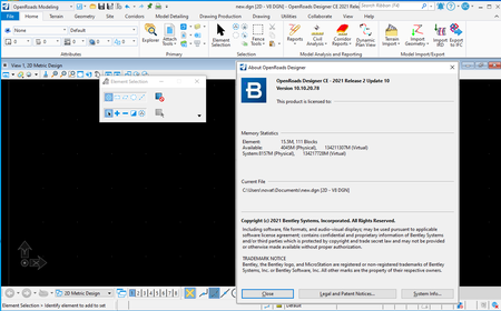
OpenRoads Designer CONNECT Edition 2021 Release 2 (10.10.20.078)

OpenRoads Designer CONNECT Edition 2021 Release 2 (10.10.20.078) | 8.5 Gb
The OpenBuildings development team is pleased to announce the availability of OpenRoads Designer 2021 Release 2 (10.10.20.078) is a comprehensive and fully functioned detailed design applicationfor surveying, drainage, utilities, and roadway design that supersedes allcapabilities previously delivered through InRoads, GEOPAK, MX, and PowerCivil.
General Enhancements
- Update of Power Platform to Edition (V10.16.02.34).
- Subscription Entitlement Service (formerly CONNECT Licensing) is utilized. For more information: Subscription Entitlement Service .
- This version uses OpenFlows SewerGEMS version 10.03.03.44.
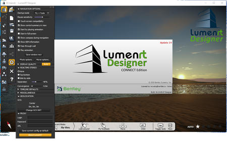
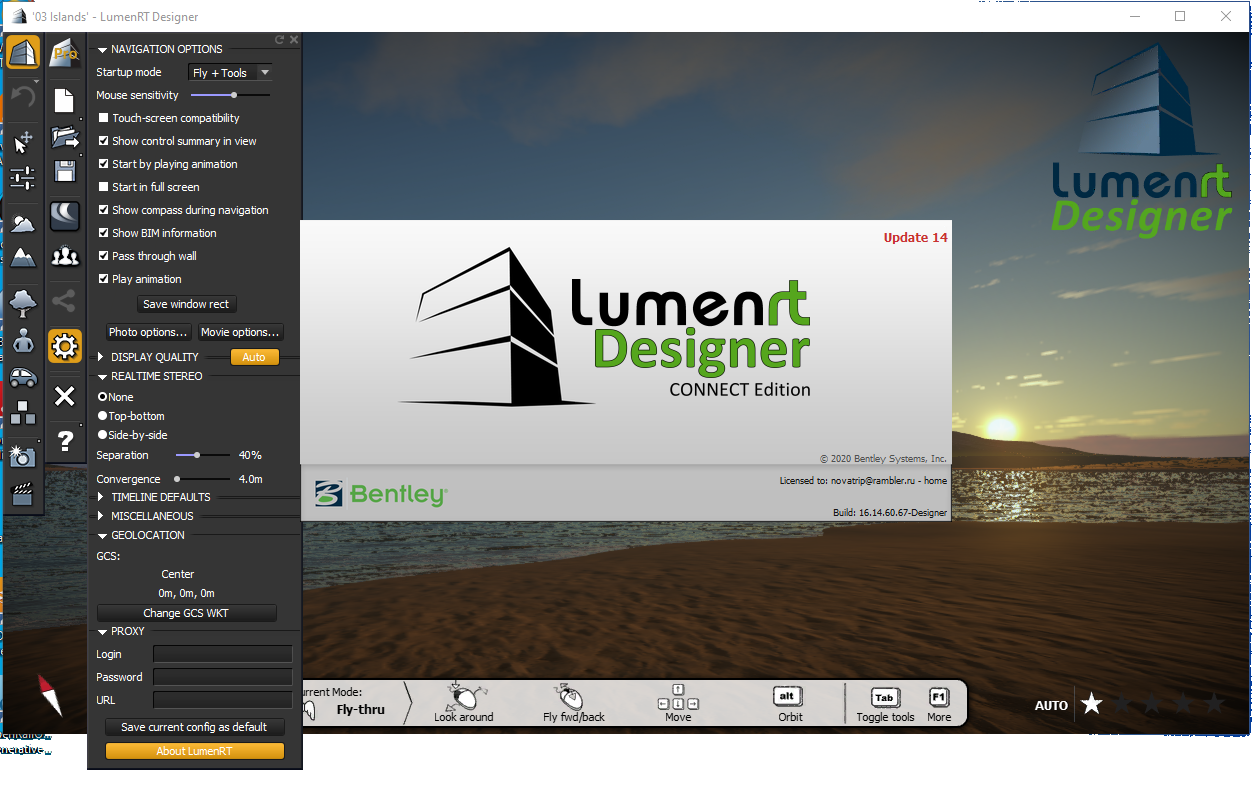
- Includes Bentley LumenRT Designer CONNECT Edition Update 14.
- Includes Bentley Descartes CONNECT Edition (V10.16.02.34).
- Update of gINT Civil Tools CONNECT Edition (V10.07.01.83).
- Support for following ProjectWise Connect Edition (V10.00.03.453).
- Includes Bentley Generative Components CONNECT Edition (V10.16.02.34).
- Continued support for side-by-side installations of major versions. 2021 Release 2 can be installed side-by-side with previous major versions such as 2020 Release 3 (10.09.00.91). The second set of digits in the product version number indicates the major version number. A 10.09 and 10.10 product can be installed side-by-side, but two 10.10 products cannot be installed side-by-side.
- Added ability to export corridor data to IFC4x3 (Release Candidate 4).
- Added the Civil File Manager tool to the backstage so it can be run directly from the software.
- Added a new tool to temporarily load a dgn or dgnlib into the active WorkSpace.
- Added a new Feature Definition Properties Viewer (technology preview) that shows the Feature Definition, Feature Symbology and Element Template properties in a single view.
- Added a new Civil Feature Re-mapper tool to update the contents of an IRD or ITL file from one standard to another such as when upgrading project data from SS2/SS10 to OpenRoads Designer.
- For workspace changes please see \Configuration\Organization-Civil\Workspace Updates - 2021 Release 2.pdf included with the delivered workspace.
Geometry Enhancements
- Enhanced the import of GENIO files by improving performance and allowing an import graphics only mode.
- Enhanced the Station Offset and Station Base Reports to allow for reporting directly on 3D linear elements and survey features (without having to convert them to geometry elements).
- Boolean CFG variable (CIVIL_RULES_PREFER_SPIRALPARAMETER=1) can be used to control what definition the user prefers the spirals to be stored and when making edits using tools "Table Editor", "Geometry Builder Edit" and "Geometry Connector".
Modeling Enhancements
- Enhanced performance for Quantities by Named Boundaries, Mass Haul, Export to IFC and End Area volume tools by multi-threading the process when boundary option is used.
- Mesh Feature Definitions that have a volume option of custom have an additional option to display/create Both or Remove Only.
- Performance is enhanced in querying models/elements for Create Point Control, Target Alias, and the Corridor Object.
Drawing Production and Annotation Enhancements
- Enhanced alignment and profile annotations so that when text is moved to a new position it will remain in that position when the annotations are updated. Previously the text would snap back to its default position.
- Plan and Profile annotations in a drawing model that uses component middle as the location will automatically be duplicated on each sheet.
- Annotate Elements tool allows the selection to include element in reference files when the "All Elements in Model" option is enabled.
- Enhanced End Area Volume annotation to be placed via grid annotation. This removed the limitation that End Area Volume annotations were only on a single corridor. The Example workspace exhibits this new capability.
- Text Fields have been added allowing for both the Arc Radial direction and Arc Tangent direction at start/stop of horizontal curves to be labeled.
- Text Field for Equivalent R Vertical Curve Parameter value has been added. EqvRvalue= 100*K.
- Rotation for point annotation has a property to be set to Relative to Point.
Item Types Enhancements
- Item Type Last Valid Values are automatically updated on all civil elements. Previously some Last Valid Values could be out of date. Item Type expressions are constantly evaluated and kept the data up to date. Last Valid Values are used to display a value when an expression cannot be evaluated such as when a civil file is opened in MicroStation. When MicroStation is not able to evaluate an expression, it will display the Last Valid Value instead of a blank.
Drainage and Utilities Enhancements
- Drainage and Utilities elements have been enhanced to improve performance and make annotation easier, particularly when working across references. Common properties such as shape, number of barrels, flow, capacity, and more are now stored on the graphical elements, which will decrease the time taken to load files with referenced databases, particularly in a ProjectWise environment. Item Types can be used to add other drainage properties. Using these new properties, the drainage databases are no longer required for annotation, or for sharing information with other designers. To utilize this new capability, drainage Text Favorites in all workspaces need to be updated to point to the new element properties instead of the database properties. Optional - The existing method of extracting drainage databases across reference files can still be used in this release by setting the configuration variable CIVIL_SUBSURFACE_LOAD_REFERENCES = 1. However, this is not recommended, particularly in a ProjectWise environment. Bentley recommends migrating all workspaces and projects to the new element-based properties as soon as practical. The ability to extract drainage databases across references will be deprecated in a future version.
- If you open a design file that contains elements in the graphics that are not in the databases, you are now asked if you want to preserve the graphics, where previously they would have been removed. This preserves the graphical data, so that it can be used for plotting, or as a reference when placing new elements.
- The ability to set minimum and maximum depths of cover on a node is now available. This enhancement makes it possible to set depths of cover on a node, to complement the existing functionality for depths of cover on a conduit. Some design standards state a minimum depth of cover on a node, to accommodate precast sections for example. If set, then when a Gradually Varied Flow scenario which is set to design the system is computed, elevations will be calculated that honor both design constraints. If the constraints differ - such as the conduit having a minimum cover that is less than the minimum cover for a node, then the lower of the two elevations is used.
- Catchment Delineation now works when a manually delineated catchment is connected to the inlet and honors its area if the two overlap. This means that you can manually delineate an area, for example to model runoff from existing ground, and also automatically delineate an area, for example to model road runoff, and connect them both to the same inlet.
- New functionality has been added to update multiple delineated catchments. This uses a selection set of inlets and will update any catchments that have been automatically delineated. This offers a more efficient workflow than updating automatically delineated areas quickly when you're not sure which areas need to be updated, because you can select all of the inlets and update their catchments in one go.
- The ability to apportion catchment runoff to gutters that flow to a sump inlet. This enhancement lets you state that if a catchment is connected to a sump inlet, which has two gutters connected to it, then the flow from the catchment should be apportioned between the gutters, as opposed to the same flow being assigned to both gutters.
- The Critical Storm Analysis wizard now caters for cross section and transition nodes, which makes it applicable to models that include ditches for example.
- The position of start and stop control structures in conduits has been adjusted, so that they are now next to the start or stop node in the profile model, when the SWMM solver is used (previously they were in the middle of the conduit). This means that the Hydraulic Grade Line better reflects reality in an unsteady-state analysis, because the control structure is located correctly.
- When the ILSAX runoff method is used, the catchment properties now show the coefficients that are used in the loss model when a predefined SOIL and AMC value are used.
- Only one Drainage and Utilities project can now be created in a design file. Existing design files that have more than one project can still be opened.
- Update of Power Platform to Edition (V10.16.02.34).
- Subscription Entitlement Service (formerly CONNECT Licensing) is utilized. For more information: Subscription Entitlement Service .
- This version uses OpenFlows SewerGEMS version 10.03.03.44.
- Includes Bentley LumenRT Designer CONNECT Edition Update 14.
- Includes Bentley Descartes CONNECT Edition (V10.16.02.34).
- Update of gINT Civil Tools CONNECT Edition (V10.07.01.83).
- Support for following ProjectWise Connect Edition (V10.00.03.453).
- Includes Bentley Generative Components CONNECT Edition (V10.16.02.34).
- Continued support for side-by-side installations of major versions. 2021 Release 2 can be installed side-by-side with previous major versions such as 2020 Release 3 (10.09.00.91). The second set of digits in the product version number indicates the major version number. A 10.09 and 10.10 product can be installed side-by-side, but two 10.10 products cannot be installed side-by-side.
- Added ability to export corridor data to IFC4x3 (Release Candidate 4).
- Added the Civil File Manager tool to the backstage so it can be run directly from the software.
- Added a new tool to temporarily load a dgn or dgnlib into the active WorkSpace.
- Added a new Feature Definition Properties Viewer (technology preview) that shows the Feature Definition, Feature Symbology and Element Template properties in a single view.
- Added a new Civil Feature Re-mapper tool to update the contents of an IRD or ITL file from one standard to another such as when upgrading project data from SS2/SS10 to OpenRoads Designer.
- For workspace changes please see \Configuration\Organization-Civil\Workspace Updates - 2021 Release 2.pdf included with the delivered workspace.
Geometry Enhancements
- Enhanced the import of GENIO files by improving performance and allowing an import graphics only mode.
- Enhanced the Station Offset and Station Base Reports to allow for reporting directly on 3D linear elements and survey features (without having to convert them to geometry elements).
- Boolean CFG variable (CIVIL_RULES_PREFER_SPIRALPARAMETER=1) can be used to control what definition the user prefers the spirals to be stored and when making edits using tools "Table Editor", "Geometry Builder Edit" and "Geometry Connector".
Modeling Enhancements
- Enhanced performance for Quantities by Named Boundaries, Mass Haul, Export to IFC and End Area volume tools by multi-threading the process when boundary option is used.
- Mesh Feature Definitions that have a volume option of custom have an additional option to display/create Both or Remove Only.
- Performance is enhanced in querying models/elements for Create Point Control, Target Alias, and the Corridor Object.
Drawing Production and Annotation Enhancements
- Enhanced alignment and profile annotations so that when text is moved to a new position it will remain in that position when the annotations are updated. Previously the text would snap back to its default position.
- Plan and Profile annotations in a drawing model that uses component middle as the location will automatically be duplicated on each sheet.
- Annotate Elements tool allows the selection to include element in reference files when the "All Elements in Model" option is enabled.
- Enhanced End Area Volume annotation to be placed via grid annotation. This removed the limitation that End Area Volume annotations were only on a single corridor. The Example workspace exhibits this new capability.
- Text Fields have been added allowing for both the Arc Radial direction and Arc Tangent direction at start/stop of horizontal curves to be labeled.
- Text Field for Equivalent R Vertical Curve Parameter value has been added. EqvRvalue= 100*K.
- Rotation for point annotation has a property to be set to Relative to Point.
Item Types Enhancements
- Item Type Last Valid Values are automatically updated on all civil elements. Previously some Last Valid Values could be out of date. Item Type expressions are constantly evaluated and kept the data up to date. Last Valid Values are used to display a value when an expression cannot be evaluated such as when a civil file is opened in MicroStation. When MicroStation is not able to evaluate an expression, it will display the Last Valid Value instead of a blank.
Drainage and Utilities Enhancements
- Drainage and Utilities elements have been enhanced to improve performance and make annotation easier, particularly when working across references. Common properties such as shape, number of barrels, flow, capacity, and more are now stored on the graphical elements, which will decrease the time taken to load files with referenced databases, particularly in a ProjectWise environment. Item Types can be used to add other drainage properties. Using these new properties, the drainage databases are no longer required for annotation, or for sharing information with other designers. To utilize this new capability, drainage Text Favorites in all workspaces need to be updated to point to the new element properties instead of the database properties. Optional - The existing method of extracting drainage databases across reference files can still be used in this release by setting the configuration variable CIVIL_SUBSURFACE_LOAD_REFERENCES = 1. However, this is not recommended, particularly in a ProjectWise environment. Bentley recommends migrating all workspaces and projects to the new element-based properties as soon as practical. The ability to extract drainage databases across references will be deprecated in a future version.
- If you open a design file that contains elements in the graphics that are not in the databases, you are now asked if you want to preserve the graphics, where previously they would have been removed. This preserves the graphical data, so that it can be used for plotting, or as a reference when placing new elements.
- The ability to set minimum and maximum depths of cover on a node is now available. This enhancement makes it possible to set depths of cover on a node, to complement the existing functionality for depths of cover on a conduit. Some design standards state a minimum depth of cover on a node, to accommodate precast sections for example. If set, then when a Gradually Varied Flow scenario which is set to design the system is computed, elevations will be calculated that honor both design constraints. If the constraints differ - such as the conduit having a minimum cover that is less than the minimum cover for a node, then the lower of the two elevations is used.
- Catchment Delineation now works when a manually delineated catchment is connected to the inlet and honors its area if the two overlap. This means that you can manually delineate an area, for example to model runoff from existing ground, and also automatically delineate an area, for example to model road runoff, and connect them both to the same inlet.
- New functionality has been added to update multiple delineated catchments. This uses a selection set of inlets and will update any catchments that have been automatically delineated. This offers a more efficient workflow than updating automatically delineated areas quickly when you're not sure which areas need to be updated, because you can select all of the inlets and update their catchments in one go.
- The ability to apportion catchment runoff to gutters that flow to a sump inlet. This enhancement lets you state that if a catchment is connected to a sump inlet, which has two gutters connected to it, then the flow from the catchment should be apportioned between the gutters, as opposed to the same flow being assigned to both gutters.
- The Critical Storm Analysis wizard now caters for cross section and transition nodes, which makes it applicable to models that include ditches for example.
- The position of start and stop control structures in conduits has been adjusted, so that they are now next to the start or stop node in the profile model, when the SWMM solver is used (previously they were in the middle of the conduit). This means that the Hydraulic Grade Line better reflects reality in an unsteady-state analysis, because the control structure is located correctly.
- When the ILSAX runoff method is used, the catchment properties now show the coefficients that are used in the loss model when a predefined SOIL and AMC value are used.
- Only one Drainage and Utilities project can now be created in a design file. Existing design files that have more than one project can still be opened.
OpenRoads Designer 2021 Release 1 Side by Side Installations
OpenRoads Designer 2021 Release 2 White Space Management
OpenRoads Designer 2021 Release 2 Performance
OpenRoads Designer CONNECT Edition 2021 Release 2 (10.10.20.078)
OpenRoads Designer CONNECT Edition 2021 Release 2 (10.10.20.078)
OpenRoads Designer is an extremely versatile civil design application that is used for all types and sizes of civil projects around the world. The application addresses a wide variety of complex tasks such as interchange design, roundabout design, earthworks, surveying, sanitary and stormwater network design, subsurface utilities, and production of construction staking reports. Traditional 2D methods are manual and tedious, full of communication and data gaps, leaving you frustrated, exhausted, and with a project that costs you accuracy, time, and money. From survey through plan production and construction documentation, OpenRoads Designer is the one application you need to meet project requirements on time, every time, regardless of change.
OpenRoads makes collaborating on 2D and 3D models easier and more efficient than ever. From team-level, work-in-progress collaboration to project-level, multidiscipline coordination, project managers, reviewers, site workers, and inspectors can view designs, perform virtual walkthroughs, query model information, and analyze embedded property data. You can automate the production of high-quality drawings, including multidiscipline documentation sets, which are consistent across the entire project. Get a live view of the project in sheet orientation. As the design changes, so will the sheets. Make edits directly in the design model and the application will update the sheets.
OpenRoads is all you need for geometrics, survey, drainage, utilities, quantity takeoff, cut/fill, site grading, lane configurations, and mobility. Ensure visibility into overall project performance with design-time analytics to achieve optimized design outcomes for a wide variety of analysis such as drainage, terrain, safety, grading, site visibility, and more. Roadway designers and engineers require software that seamlessly collaborates across disciplines, addresses growing industry demands, and includes automation to remove tedious manual work. Whether you need to produce traditional 2D deliverables, advance to 3D modeling, support digital transformation, or all the above, OpenRoads is the choice for road design.
Even as the transportation industry is moving towards the creation of 3D models, the need for a variety of deliverables continues to be part of the project workflow. With OpenRoads, you can create whatever deliverables you might need. Experience your designs in real time with constraint-driven templates, a context sensitive intuitive interface, and dynamic 3D modeling. Visualize the design at any time and on demand within the modeling workflow. No translations, software, or special workflow process is needed. Whether it is 2D or 3D, plans or models, digital or paper, OpenRoads is designed to allow you to work in all these arenas simultaneously, leveraging information from one to help populate the other. Our 3D models can be leveraged for 4D scheduling and 5D cost estimation, bringing your design to constructed fruition, on time and on budget.
OpenRoads Designer
Bentley Systems is a software development company that supports the professional needs of those responsible for creating and managing the world’s infrastructure.
Product: OpenRoads Designer
Version: CONNECT Edition 2021 Release 2 (10.10.20.078)
Supported Architectures: x64
Website Home Page : www.bentley.com
Languages Supported: english
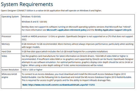
System Requirements: Windows *
Size: 8.5 Gb
OpenRoads Designer CONNECT Edition 2021 Release 2 (10.10.20.078)
Please visit my blog
Added by 3% of the overall size of the archive of information for the restoration
No mirrors please

![OpenRoads Designer CONNECT Edition 2021 Release 2 (10.10.20.078)]()
Added by 3% of the overall size of the archive of information for the restoration
No mirrors please
OpenRoads Designer CONNECT Edition 2021 Release 2 (10.10.20.078)
