

OpenSite Designer CONNECT Edition 2021 R2 Update 10
OpenSite Designer CONNECT Edition 2021 R2 Update 10 | 8.8 Gb
The Bentley Systems team is pleased to announce the availability of OpenSite Designer Connect Edition 2021 Release 2 Update 10 (10.10.21.004) is integrated application for civil site and land development workflows across conceptual, preliminary, and detailed design phases.
What is New OpenSite Designer CONNECT Edition 2021 Release 2
This section provides a list of new features in Bentley OpenSite, OpenRoads, and OpenRail Designer CONNECT Edition products, also referred to OpenX Designer products. Features that are only available in specific products are appropriately noted as such. The following summarizes the new features and enhancements in this 2021 Release 2.
General Enhancements
- Update of Power Platform to Edition (V10.16.02.34).
- Subscription Entitlement Service (formerly CONNECT Licensing) is utilized. For more information: Subscription Entitlement Service .
- This version uses OpenFlows SewerGEMS version 10.03.03.44. More information here: What's New in SewerGEMS, CivilStorm, StormCAD, SewerCAD, and SewerOPS CONNECT Edition Update 3 (version 10.03.04.53) - OpenFlows | Hydraulics and Hydrology Wiki - OpenFlows | Hydraulics and Hydrology - Bentley Communities
- Includes Bentley LumenRT Designer CONNECT Edition Update 14.
- Includes Bentley Descartes CONNECT Edition (V10.16.02.34).
- Update of gINT Civil Tools CONNECT Edition (V10.07.01.83).
- Support for following ProjectWise Connect Edition (V10.00.03.453).
- Includes Bentley Generative Components CONNECT Edition (V10.16.02.34).
- Continued support for side-by-side installations of major versions. 2021 Release 2 can be installed side-by-side with previous major versions such as 2020 Release 3 (10.09.00.91). The second set of digits in the product version number indicates the major version number. A 10.09 and 10.10 product can be installed side-by-side, but two 10.10 products cannot be installed side-by-side.
- Added ability to export corridor data to IFC4x3 (Release Candidate 4).
- Added the Civil File Manager tool to the backstage so it can be run directly from the software.
- Added a new tool to temporarily load a dgn or dgnlib into the active WorkSpace.
- Added a new Feature Definition Properties Viewer (technology preview) that shows the Feature Definition, Feature Symbology and Element Template properties in a single view.
- Added a new Civil Feature Re-mapper tool to update the contents of an IRD or ITL file from one standard to another such as when upgrading project data from SS2/SS10 to OpenRoads Designer.
- For workspace changes please see \Configuration\Organization-Civil\Workspace Updates - 2021 Release 2.pdf included with the delivered workspace.
Geometry Enhancements
- Enhanced the import of GENIO files by improving performance and allowing an import graphics only mode.
- Enhanced the Station Offset and Station Base Reports to allow for reporting directly on 3D linear elements and survey features (without having to convert them to geometry elements).
- Boolean CFG variable (CIVIL_RULES_PREFER_SPIRALPARAMETER=1) can be used to control what definition the user prefers the spirals to be stored and when making edits using tools "Table Editor", "Geometry Builder Edit" and "Geometry Connector".
Modeling Enhancements
- Enhanced performance for Quantities by Named Boundaries, Mass Haul, Export to IFC and End Area volume tools by multi-threading the process when boundary option is used.
- Mesh Feature Definitions that have a volume option of custom have an additional option to display/create Both or Remove Only.
- Performance is enhanced in querying models/elements for Create Point Control, Target Alias, and the Corridor Object.
Drawing Production and Annotation Enhancements
- Enhanced alignment and profile annotations so that when text is moved to a new position it will remain in that position when the annotations are updated. Previously the text would snap back to its default position.
- Plan and Profile annotations in a drawing model that uses component middle as the location will automatically be duplicated on each sheet.
- Annotate Elements tool allows the selection to include element in reference files when the "All Elements in Model" option is enabled.
- Enhanced End Area Volume annotation to be placed via grid annotation. This removed the limitation that End Area Volume annotations were only on a single corridor. The Example workspace exhibits this new capability.
- Text Fields have been added allowing for both the Arc Radial direction and Arc Tangent direction at start/stop of horizontal curves to be labeled.
- Text Field for Equivalent R Vertical Curve Parameter value has been added. EqvRvalue= 100*K.
- Rotation for point annotation has a property to be set to Relative to Point.
Drainage and Utilities Enhancements
- Drainage and Utilities elements have been enhanced to improve performance and make annotation easier, particularly when working across references. Common properties such as shape, number of barrels, flow, capacity, and more are now stored on the graphical elements, which will decrease the time taken to load files with referenced databases, particularly in a ProjectWise environment. Item Types can be used to add other drainage properties. Using these new properties, the drainage databases are no longer required for annotation, or for sharing information with other designers. To utilize this new capability, drainage Text Favorites in all workspaces need to be updated to point to the new element properties instead of the database properties. Optional - The existing method of extracting drainage databases across reference files can still be used in this release by setting the configuration variable CIVIL_SUBSURFACE_LOAD_REFERENCES = 1. However, this is not recommended, particularly in a ProjectWise environment. Bentley recommends migrating all workspaces and projects to the new element-based properties as soon as practical. The ability to extract drainage databases across references will be deprecated in a future version.
- If you open a design file that contains elements in the graphics that are not in the databases, you are now asked if you want to preserve the graphics, where previously they would have been removed. This preserves the graphical data, so that it can be used for plotting, or as a reference when placing new elements.
- The ability to set minimum and maximum depths of cover on a node is now available. This enhancement makes it possible to set depths of cover on a node, to complement the existing functionality for depths of cover on a conduit. Some design standards state a minimum depth of cover on a node, to accommodate precast sections for example. If set, then when a Gradually Varied Flow scenario which is set to design the system is computed, elevations will be calculated that honor both design constraints. If the constraints differ - such as the conduit having a minimum cover that is less than the minimum cover for a node, then the lower of the two elevations is used.
- Catchment Delineation now works when a manually delineated catchment is connected to the inlet and honors its area if the two overlap. This means that you can manually delineate an area, for example to model runoff from existing ground, and also automatically delineate an area, for example to model road runoff, and connect them both to the same inlet.
- New functionality has been added to update multiple delineated catchments. This uses a selection set of inlets and will update any catchments that have been automatically delineated. This offers a more efficient workflow than updating automatically delineated areas quickly when you're not sure which areas need to be updated, because you can select all of the inlets and update their catchments in one go.
- The ability to apportion catchment runoff to gutters that flow to a sump inlet. This enhancement lets you state that if a catchment is connected to a sump inlet, which has two gutters connected to it, then the flow from the catchment should be apportioned between the gutters, as opposed to the same flow being assigned to both gutters.
- The Critical Storm Analysis wizard now caters for cross section and transition nodes, which makes it applicable to models that include ditches for example.
- The position of start and stop control structures in conduits has been adjusted, so that they are now next to the start or stop node in the profile model, when the SWMM solver is used (previously they were in the middle of the conduit). This means that the Hydraulic Grade Line better reflects reality in an unsteady-state analysis, because the control structure is located correctly.
- When the ILSAX runoff method is used, the catchment properties now show the coefficients that are used in the loss model when a predefined SOIL and AMC value are used.
- Only one Drainage and Utilities project can now be created in a design file. Existing design files that have more than one project can still be opened.
Item Types Enhancements
- Item Type Last Valid Values are automatically updated on all civil elements. Previously some Last Valid Values could be out of date. Item Type expressions are constantly evaluated and kept the data up to date. Last Valid Values are used to display a value when an expression cannot be evaluated such as when a civil file is opened in MicroStation. When MicroStation is not able to evaluate an expression, it will display the Last Valid Value instead of a blank.
OpenSite Designer CONNECT Edition 2021 R2 Update 10
OpenSite Designer CONNECT Edition 2021 R2 Update 10

OpenSite Designer CONNECT Edition 2021 R2 Update 10

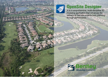
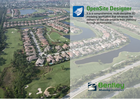
OpenSite Designer CONNECT Edition is the successor to Bentley’s design brands GEOPAK Site, GEOPAK Survey, InRoads Site, InRoads Site Suite, InRoads Storm and Sanitary, InRoads Survey, PowerSurvey, MXGRONDWERK, MXGRONDWERK Addin, MXSITE, MXSUBDIV, Bentley topoGRAPH, Bentley topoGRAPH Projects, Bentley Subsurface Utility Engineering. It is a comprehensive, multi-discipline 3D modeling application that advances the delivery of civil site projects from planning through performance.
OpenSite Designer blends traditional engineering workflows for plan, profile, and earthworks with 3D parametric modeling and earthwork optimization to enable the model-centric creation of all design deliverables.
OpenSite Designer handles a wide variety of complex tasks such as parking configurations, analysis earthwork financial risk, residential layout, handicap parking and accessibility, site development, sanitary and stormwater network design, and producing construction staking reports.
OpenSite Designer enables users to create intelligent geometrics and 3D models containing site information, terrain data, parking lots, building pads, driveways, sidewalk, parcel layout and related site features. OpenSite Designer provides a comprehensive modeling environment and addresses all phases of project delivery. It provides a breadth of applications to meet the demands of each phase of the project lifecycle, including:
- Contextual Design. All detailed design in OpenSite Designer is driven by functional components, which inherently respond contextually to express appropriate design, annotation, and plan set display behaviors. Design models are expressed in multiple live views including plan, profile, and 3D. Changes in one view are live and dynamically update all views
- Multi-discipline Support. OpenSite Designer integrates support for each discipline with specific user profiles dedicated to each discipline. Users can switch discipline perspectives, for instance from grading design to subsurface utility design.
- Reality Modeling Tools. OpenSite Designer includes a fully functional toolset to incorporate and edit reality modeling data types, including the capability to extract ground-level features from reality meshes and LiDAR, as well as to reference point clouds and imagery.
- Geotechnical Tools. Users can connect directly to gINT geotechnical databases to incorporate subsurface terrain details into
- their models for improving grading and piling. Subsurface terrains can be generated or modeled based on the bore hole materials and projected in road and drainage profiles, sections, and plans.
- Subsurface Utilities. Users can select from a large catalog of functional components for utility and drainage to model underground drainage and utility networks. Drainage models can be optimized for water flow using integrated water analysis capabilities, with results available in data tables or visually in a profile view.
- Rich Deliverables. An expanded set of deliverables range from traditional plan sets and animations to digital construction models—for automated machine control and field positioning systems for excavation, grading, and piling.
- Live Plan Generation. Plan generation no longer needs to be a separate process limited to a point in time, as settings and annotations are dynamically updated and live in the model. Views are saved with specific display rules and sheet index embedded, making it easy to navigate between the model and drawings. Up-to-date drawings can be generated automatically at any time, creating a natural and fluid design environment for both modeling and detailing.
- Enlivened Visualization. OpenSite Designer provides direct integration to LumenRT to produce cinematic visualization, adding vegetation, reflecting nature, and climate.
Designs created in OpenSite Designer benefit from BIM Review through Navigator, in the office, field, and at the site. Navigator enables not only visualization and review of 3D designs, but also status visibility—allowing dispersed teams to progress approvals and the resolution of issues
This video demonstrates where the predefined design parameters and layout properties are configured inside of OpenSite Designer.
Bentley Systems is a software development company that supports the professional needs of those responsible for creating and managing the world’s infrastructure.
Product: OpenSite Designer
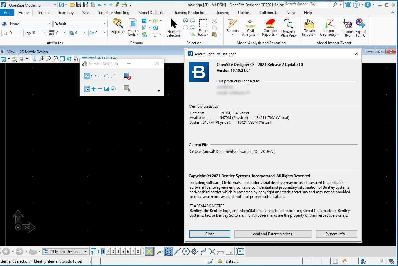
Version: CONNECT Edition 2021 R2 Update 10 (10.10.21.004) *
Supported Architectures: x64
Website Home Page : www.bentley.com
Languages Supported: english
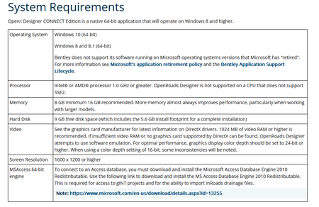
System Requirements: Windows **
Size: 8.8 Gb
OpenSiteDesignerx64_10.10.21.004.exe
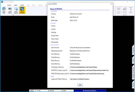
OpenSite-SITEOPS-10.10.20.1.exe
LumenRT_Designer_english_16.14.60.67_28882.exe
OpenSite-SITEOPS-10.10.20.1.exe
LumenRT_Designer_english_16.14.60.67_28882.exe
OpenSite Designer CONNECT Edition 2021 R2 Update 10

Please visit my blog
Added by 3% of the overall size of the archive of information for the restoration
No mirrors please

![OpenSite Designer CONNECT Edition 2021 R2 Update 10]()
Added by 3% of the overall size of the archive of information for the restoration
No mirrors please
OpenSite Designer CONNECT Edition 2021 R2 Update 10
