


iGO My way 8 Content Update (09. 2008) - All Europa + Australia
iGO My way 8 Content Update (September 2008) | 2,05 Gb
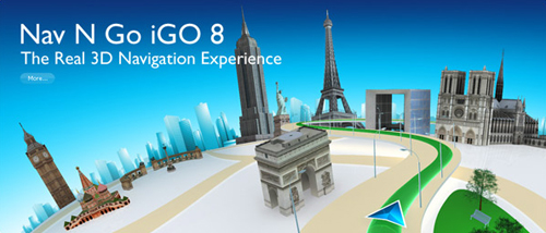
Map (.dem, .poi, fbl, 3dc, 3dl) - All Europa + Australia. iGO My way 8 brings rich 3D experience to handheld devices. Nav N Go has launched the latest version of their popular GPS navigation software at CeBIT 2007 in Hannover. iGO My way 8 represents a breakthrough in 3D rendering technology on handheld devices. It can display shaded and textured topographic elements, in addition to 3D building models, providing an even more realistic view.

iGO My way 8 Content Update (09. 2008) - All Europa + Australia
1) Copy into flash card.
2) Be proud and gay. Wank Wank on VLK pictures. MRDEJ
Note - Few maps are included twice. Difference is in source. Local providers
have better coverage but they also can have own routing issues,
speed limits might be not included or so.
Pick map which better suits your needs.
Terrain (DEM) files
Benelux, BritishIsles, Europe NASA, France, Italy, Russia
Local map/poi providers
Bulgaria, Greece, Hungary, Poland, Slovakia, Turkey, Ukraine
TeleAtlas map/poi/3D buildings
Albania, Andorra, Austria, Basemap, Belarus, Belgium, BosniaHrz, Bulgaria, Croatia, CzechRep, Denmark, Estonia, Finland, France, FYROM, Germany, Gibraltar, Greece, Hungary, Ireland, Italy, Latvia, Liechtenstein, Lithuania, Luxembourg, Malta, Moldova, Monaco, Montenegro, Netherlands, Norway, Poland, Portugal, Romania, Russia, SanMarino, Serbia, Slovakia, Slovenia, Spain, Sweden, Switzerland, Turkey, Ukraine, United Kingdom, Vatican,
East Europe Major Roads
West Europe Major Roads
Download