

Mechdyne vGeo 4.0
Mechdyne vGeo 4.0 | 145 MB
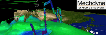
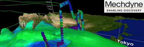
The Virtual Global Explorer and Observatory (vGeo) is an interactive data fusion and visual analysis tool designed to meet the complex challenges faced by today's scientists, engineers and simulation analysts. A vGeo user can navigate and interact with a time varying, three-dimensional world constructed from many large, multivariate data sets including observations, computer simulations, images, and model objects. By taking advantage of the ability to recognize data patterns by seeing them - as animated 3D objects in an immersive environment - users often discover features and relationships that might go otherwise unnoticed.
Key Features
Whatever the type and source of your data, if it's 3D in nature, vGeo offers an easy-to-use, advanced visualization solution at an affordable price.
vGeo is available for IRIX, LINUX, or Windows operating systems. In addition, vGeo can be configured to drive a cluster of PC workstations in support of a multi-wall or multi-tile display system.
To learn more about the specific key features, click on the links belo