

Aquaveo Watershed Modeling System (WMS) 11.3.2
Aquaveo Watershed Modeling System (WMS) 11.3.2 | 1.7 Gb
Aquaveo, a water resources consulting company, is pleased to announce availability Watershed Modeling System (WMS) 11.3.2 is a complete watershed solution used for automated delineation, hydrologic & hydraulic modeling, floodplain mapping, and storm drain modeling.
What's new in WMS 11.3.2 - May 21, 2025
Hydrologic Data
- 15290 WMS Crash with SCOUR_PARMS
- 15316 WMS crash with GQ-AD-FLAGS
- 15616 TR-55 Peak Discharge in Hydrograph is Much Higher than Computed in TR-55 Run Simulation Dialog
Import
- 15415 While importing from web SMS gets stuck loading for certain rater cell sizes
Rasters
- 15477 XMS Can't Import Rasters if They Are 8 Bit
- 15542 Trim Raster Issue
- 15549 Trim Raster Issue
- 15530 Problems displaying raster, image, and online image data near the north (or south) poles
- 15531 Problems displaying raster data near the north (or south) poles
- 15456 Raster dataset tools failing to create raster with error raster already exists when it doesn't
Online Maps
- 15413 Wisconsin County Projections Don't Allow Import of Wisconsin County Map Data
- 15608 Get online maps Dialog is opening instead of Map locator dialog when having modeling wizard open
Toolbox
- 15562 More image projection bugs - specifically with "Merge" and "Trim" rasters
HY-8
- 15584 WMS Crash in HY-8 Modeling Wizard Storage Capacity Data
HydraulicToolbox
- 15426 Inconsistent Units Between Project and Hydraulic Toolbox Calculations for Detention Basin Calculator
HEC-1
- 15483 WMS Error Cards not processed followed with random characters while opening .gpr file
Projection
- 15610 A couple of projection issues.
Display
- 15580 Contour interval display settings not saving when project is closed and reopened
- 15581 Display settings for background color not saving
GSSHA
- 15579 GSSHA runs on some computers but not others

Aquaveo Watershed Modeling System (WMS) 11.3.2
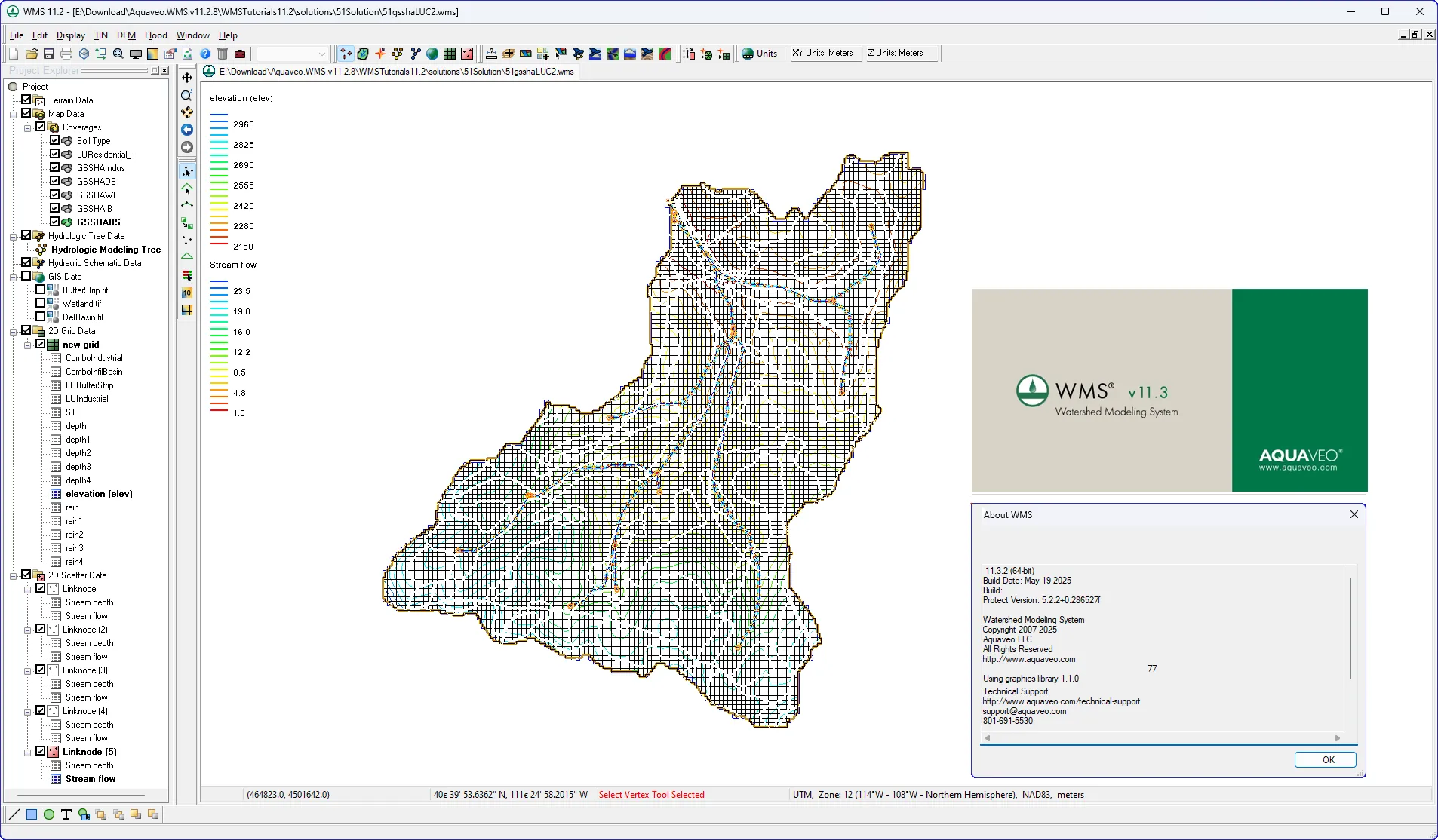
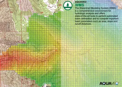
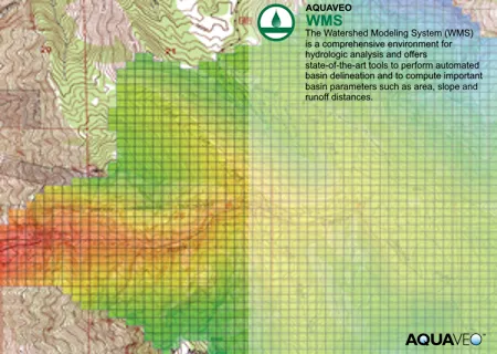
The Watershed Modeling System (WMS) is a comprehensive environment for hydrologic analysis. It was developed by the Environmental Modeling Research Laboratory of Brigham Young University in cooperation with the U.S. Army Corps of Engineers Waterways Experiment Station. The software is currently being developed by Aquaveo. WMS offers state-of-the-art tools to perform automated basin delineation and to compute important basin parameters such as area, slope and runoff distances. It serves as a graphical user interface for several hydraulic and hydrologic models. With its management of coordinate systems, WMS is capable of displaying and overlaying data in real world coordinates. The application also provides many display tools for viewing terrain surfaces and exporting images for reports and presentations.
WMS
Instructional videos for the Watershed Modeling System (WMS) program developed by Aquaveo.
Aquaveo is a pioneer of GIS-based software solutions for hydraulic, hydrologic and groundwater modeling. Our products have been refined over two decades to create the most advanced environmental modeling and visualization software available. In addition to interfacing with industry standard numerical models, we develop custom desktop and cloud-based applications tailored to specific needs. Aquaveo began as a part of the Engineering Computer Graphics Laboratory at Brigham Young University in 1985. The lab was reorganized and the name was changed in September, 1998 to the Environmental Modeling Research Laboratory (EMRL). In April, 2007, the main software development team at EMRL entered private enterprise as Aquaveo, LLC.
Owner: Aquaveo
Product Name: Watershed Modeling System (WMS)
Version: 11.3.2
Supported Architectures: x64
Website Home Page : www.aquaveo.com
Languages Supported: english
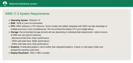
System Requirements: Windows *
Size: 1.7 Gb
Aquaveo Watershed Modeling System (WMS) 11.3.2
Please visit my blog
Added by 3% of the overall size of the archive of information for the restoration
No mirrors please

![Aquaveo Watershed Modeling System (WMS) 11.3.2]()
Added by 3% of the overall size of the archive of information for the restoration
No mirrors please
Aquaveo Watershed Modeling System (WMS) 11.3.2
