


Arqcom CAD-Earth 7.0.2

Arqcom CAD-Earth 7.0.2 | 148.4 mb
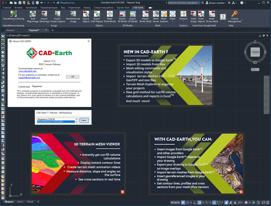
The software developer Arqcom Software is pleased to announce the availability of CAD-Earth 7.0.2, is designed to easily import/export images, objects and terrain meshes between Google Earth and major CAD programs and also create dynamic contour lines and profiles.
NEW in CAD-Earth 7.0
Import and export 3D models from DAE, 3DS, FBX, and OBJ files to AutoCAD, and export them and other 3D entities such as 3D solids, regions, meshes or polymeshes to Google Earth. 3D entities contained in regular or nested blocks can also be exported.
New mesh commands.
- Edit the mesh using commands to insert, delete, move, adjust elevation, flatten vertices, and invert, delete, or cut triangles. Break lines can be inserted to refine the terrain configuration. The mesh can be smoothed and adjusted to a control mesh or control points.
- Create terrain meshes from existing entities, such as points, 3D faces, contour polylines or 3D polylines.
- Import and export terrain mesh. Import a mesh from Lidar LAS and DEM files (TIFF, DEM, HGT, E00, MEM, CAT.DDF), specifying mesh properties and refinement options and other processing parameters, with the option to process the entire file or to select the area to process. Export the terrain mesh to a text XYZ or a GeoTIFF file.
- Mesh visualization styles. Display one or several mesh terrain elements, such as vertices, triangulation, boundary, contour lines, elevation and slope ranges and slope arrows. You can edit, create, delete and save a visualization style and choose which elements you want to display. Color, line type width and scale, text style and size can be adjusted, and parameter values can be modified.
New tools.
- Terrain Mesh Explorer. A floating palette tool to organize your projects and have access to mesh importing, editing and visualization commands. By right-clicking on a tree node, you can add subproject folders and terrain mesh nodes. Right-clicking on a node, a context menu will be displayed to select commands according to the node selected.
- Profile Viewer. Display profile sections from selected terrain meshes by defining a cutting line specifying two points. You can adjust the vertical scale for the profiles, measure distance and slope selecting two points in the Profile Viewer, and zoom to extents or to a window, increase or decrease the view size, pan view, and show or hide the reference grid.
New Earth Takeoff commands.
- Perform cut/fill volume calculations by the grid method. Depths between the mesh and a comparison mesh are calculated at every grid intersection inside a defined region. Every element of the grid can be customized, specifying line type, color, layer and scale, text size, style, and color.
- An summary volume report can be created, showing the average cut/fill depth, the cell partial area, cut/fill area, and volume at each grid station. The grid cell width and height, shrinkage percent, strip topsoil depth, and net cut/fill areas and volumes will also be shown. This spreadsheet will be automatically opened in Excel® after finalizing volume calculations.
New improvements
- Option to save the image in the drawing when importing images or terrain meshes, avoiding empty images when the file is not found.
- Entities contained in blocks and nested blocks can now be exported to Google Earth. A KMZ file will be created containing all the information to display the objects in Google Earth.
- When exporting AutoCAD screen captures to Google Earth, a KMZ file will be created with the image files included, to avoid displaying empty images when the files are not found.
Arqcom CAD-Earth 7.0.2

What can I do with CAD-Earth?
- Insert images from Google Earth an other providers. You can select different service providers (Google Earth, Google, Bing), image resolution (normal, medium, high, highest) and image mode (satellite, map, hybrid). Images can be imported to AutoCAD in full color or grayscale in major image formats (BMP, JPEG, TIFF) and can be clipped inside a closed polyline. A world text file containing spatial data information can be created to georeference imported images.
- Import Google Earth objects to AutoCAD. Polygons, routes and placemarks can be imported from Google Earth to AutoCAD and AutoCAD based products, such as Civil 3D©. Polygons can be imported as 2D or 3D polylines projected to terrain, optionally applying fill color. Placemarks can be imported as blocks with elevation, including placemark name and description. A symbol library is included where you can select the placemark block to be inserted or you can add your own blocks.
- Insert georeferenced images. If you have image files with the corresponding world file containing spatial data information you can accurately place them in the drawing automatically applying XY scale and translation transformations.
- Export CAD objects to Google Earth. Lines, polylines, arc, circles, points can be exported to Google Earth as polygons, routes or placemarks. Object line thickness, outline, fill color and opacity can be adjusted. Curve smoothness can be controlled specifying the maximum segment length and deflection angle. Placemark name, description, scale and icon can also be set.
- Export CAD screenshots to Google Earth. AutoCAD drawings can be exported to Google Earth as image overlays. Image capture can be in full color, grayscale or B&W an can be in any of the major image formats (BMP, JPEG, TIFF, PNG, GIF). Background color can be completely transparent or can be changed to another color if desired. Screenshots can also be taken in sections to increase final image resolution.
- Get contour lines, profiles and sections from Google Earth (Plus version). A terrain configuration mesh can be created inside an existing closed polyline or along a polyline path calculating point elevations from Google Earth. By specifying the rotation angle and resolution the mesh density and precision can be adjusted. The resulting mesh can be used to obtain contour lines, dynamic profiles and section drawings complete with annotations. The terrain mesh can be exported to a LandXML file to be imported by another applications that can create surfaces from a LandXML file, such as Civil 3D©.
CAD Earth V7 new features
ARQCOM S.A. de C.V. is a company located in Baja California, Mexico, dedicated to developing programs or modules for Autocad, the leading computer-aided design program.
Product: Arqcom CAD-Earth
Version: 7.0.2
Supported Architectures: x64
Website Home Page : https://cad-earth.com/
Languages Supported: english
System Requirements: PC *
Size: 148.4 mb
CAD-Earth doesn’t need any additional requirements from the ones needed to run your CAD program optimally (please consult your documentation). Google Earth Free or Pro version 5 or newer must be installed in your computer.
Currently, CAD-Earth works in Microsoft Windows 10/8.1/8/7 in 64 bits and in the following CAD programs: AutoCAD Full 2018-2022 (and vertical products i.e. Civil3D, Map, etc)
Currently, CAD-Earth works in Microsoft Windows 10/8.1/8/7 in 64 bits and in the following CAD programs: AutoCAD Full 2018-2022 (and vertical products i.e. Civil3D, Map, etc)
Please visit my blog
Added by 3% of the overall size of the archive of information for the restoration
No mirrors please

![Arqcom CAD-Earth 7.0.2]()
Added by 3% of the overall size of the archive of information for the restoration
No mirrors please
Arqcom CAD-Earth 7.0.2
