

Global Mapper 17.0.2 Build 101915 (x86/x64)

Global Mapper 17.0.2 Build 101915 (x86/x64) | 157/156 Mb
Global Mapper is an affordable and easy-to-use GIS application that offers access to an unparalleled variety of spatial datasets and provides just the right level of functionality to satisfy both experienced GIS professionals and beginning users. Equally well suited as a standalone spatial data management tool and as an integral component of an enterprise-wide GIS, Global Mapper is a must-have for anyone who deals with maps or spatial data.
• Low-cost and easy-to-use GIS solution
• Supports over 250 spatial data formats
• Optional LiDAR Module for advanced processing
• Leverage the power of GeoCalc's library with the new tool bar
• Now includes all features previously found in Global Energy Mapper®
• Unmatched and complimentary technical support
Global Mapper is more than just a utility; it has built in functionality for distance and area calculations, raster blending, feathering, spectral analysis, elevation querying, line of sight calculations, cut-and-fill volume calculations, as well as advanced capabilities like image rectification, contour generation from surface data, view shed analysis, watershed delineation, sea level rise modeling, terrain layer comparison, and triangulation and gridding of 3D point data.
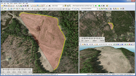
Global Mapper 17 features numerous new and improved geospatial tools, functional upgrades, and performance improvements throughout all areas of the application. Significant new functionality includes a multi-view map interface allowing the simultaneous viewing and docking of several map widows as well as a completely redesigned map layout function for creating high-quality printed maps.
The new multi-view map display allows several docked map windows to be displayed within the interface. These views, which support both top-down 2D rendering as well as oblique 3D viewing, can be independently zoomed and panned and can be resized to make the most efficient use of the available screen space. The all-new Map Layout tools provide the necessary functionality for designing state-of-the-art printed maps. Cartographic elements such as a scale bar, compass rose, and map legend can be precisely placed within the layout frame and supplementary text and corporate branding graphics can be easily added to the design and saved as a template for future use.
Additional new functionality in Global Mapper v17 includes support for 3D models as custom symbols that are assigned to point features. These models appear as three-dimensional objects in the 3D Viewer. Several new data formats and online map services have been added including the US National map, which includes 1-foot color imagery, and World Navigation Charts at a 1:1,000,000 scale. The LiDAR Module also incorporates significant upgrades including several new filtering and point cloud clean-up options.
Global Mapper's data processing and map rendering engine continue to show dramatic performance improvements. Version 17 sees raster display, redraw, and export speeds that are up to ten times faster than in previous versions and LiDAR processing is also significantly faster.
Home Page - http://www.globalmapper.com
If Links are broken, PM me! Files will be reuploaded ASAP :)
No mirrors please
No mirrors please