


Trimble Business Center 5.20

Trimble Business Center 5.20 | 4.2 Gb
Trimble introduced a new version of its powerful office software suite used by surveyors and geospatial professionals for processing and analyzing geospatial data—Trimble Business Center 5.20
What's new in Trimble Business Center 5.20 - Date: November 18, 2019
This latest release strengthens TBC’s unique position as the single office software of choice for surveyors and construction professionals with the following new or improved features:
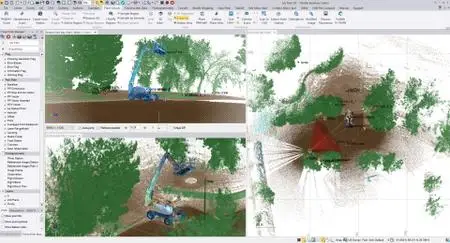
Trimble X7 Laser Scanning Support
Trimble Business Center 5.20
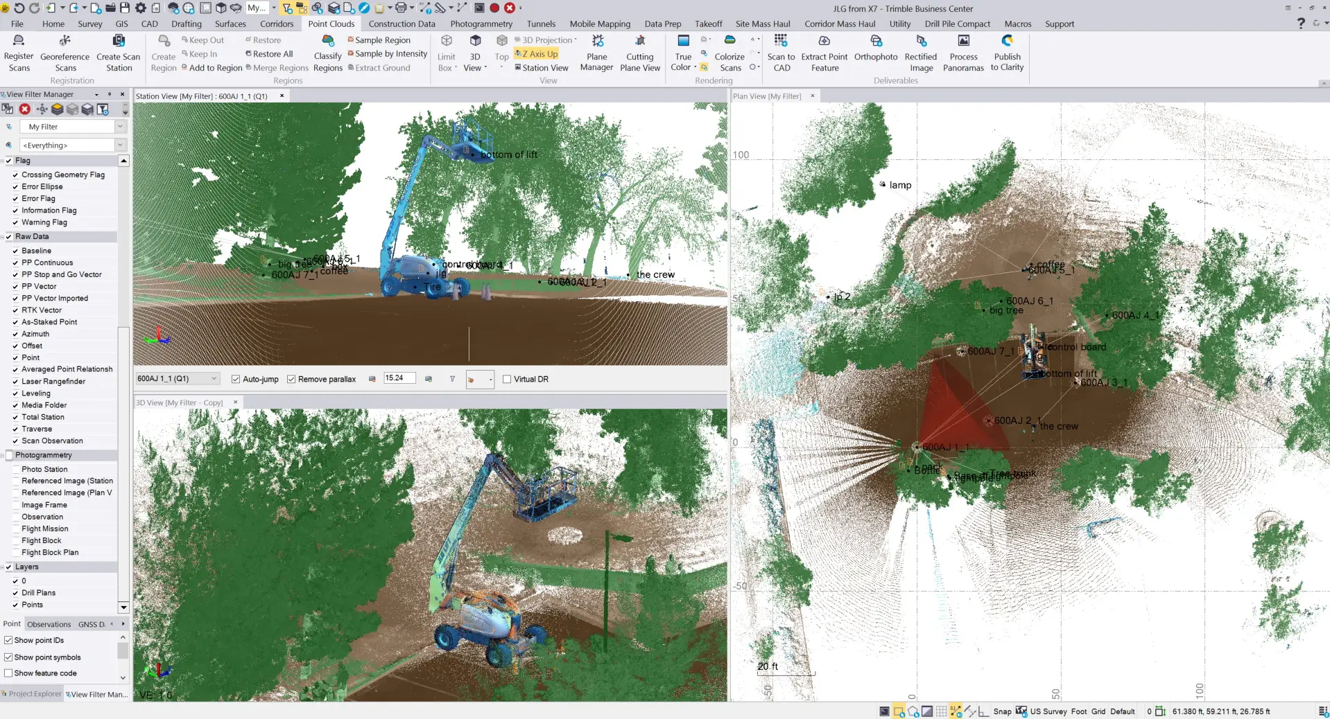
TBC 5.2 now supports drag-and-drop Trimble Perspective (field software) data files from the Trimble X7 scanner. There is also support for Perspective’s scan labels, field annotations and images within existing TBC features to reduce the learning curve of using a new scanning system. X7 scan data also integrates seamlessly with TBC’s scanning workflows, other field survey data, and CAD drafting functionality.
Publish Survey Data and Point Cloud Data to Trimble Clarity
Trimble Business Center 5.20

Trimble Clarity is an online 3D point cloud and model viewer that allows you to display and share your files using Trimble Connect, Google Drive, or Dropbox. The intuitive interface allows you to view in 3D or in station view, make measurements, annotate features, save frames, share with others. You can manage point clouds and models to update your clients and drive insights.
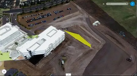
Prepare Models for Trimble SiteVision

Trimble Business Center 5.20
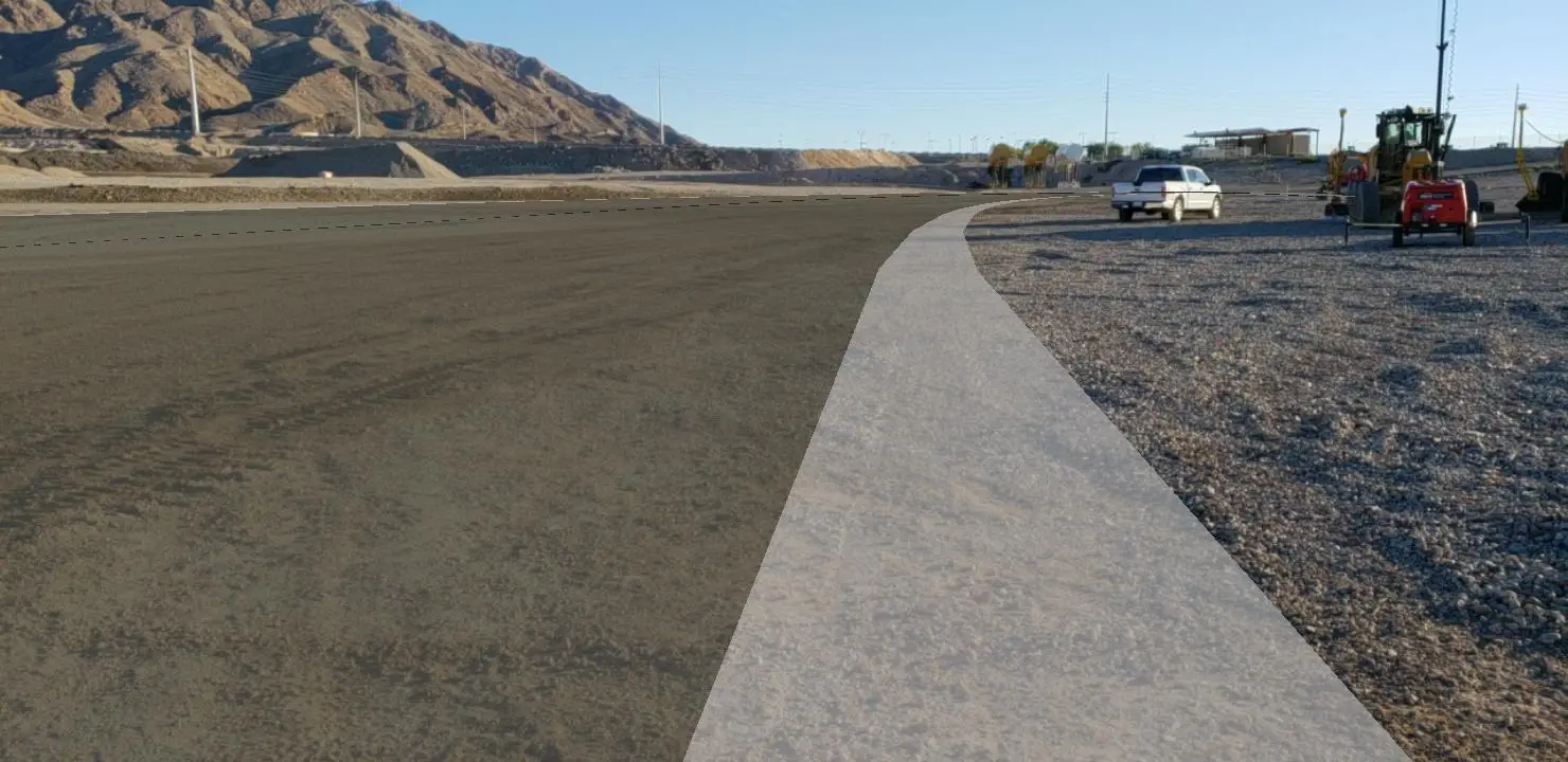
Trimble SiteVision is a new Augmented Reality (AR) system that allows you to overlay 3D models on top of a real-world view from a smartphone. With TBC v5.20 you can prepare data for SiteVision from existing CAD files, TBC CAD tools and modules, survey field data, corridors, surfaces, utility modeling data. Move from TBC to SiteVision using a dedicated exporter (*.vcl), LandXML, or IFC. This will enable you to use SiteVision for visualization, virtual staking, cut/fill maps, inspection, construction verification and utility locations.
Parametric Vertical Design Tools
TBC 5.2 now has 11 parametric rules to elevate lines:
- Cross-slope
- Elevation
- Cross dZ
- Connector
- VPI
- Free-slope
- Free-dZ
- Grade
- Transition
- Tilt
- Breakline
This will help you model complex and variable relationships such as intersection curb cuts or cross-slope transitions. As rules update, the geometry also updates. If geometry is used in surface, the surface will also update dynamically.
UAV Processing Engine Update
We have improved processing speed for camera calibration and surface generation. We also now provide better tie point matching and camera modeling for enhanced georeferencing, which leads to more successful processing of challenging field data (i.e. lack of contrast). There is better distribution of automatic tie-points for more tie-points and precise image measurements even in low textured areas. Finally there is now support for imagery up to 103 Mpixel.
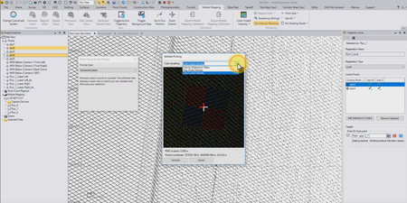
Plane Picker for MX9 Registration
Trimble Business Center 5.20
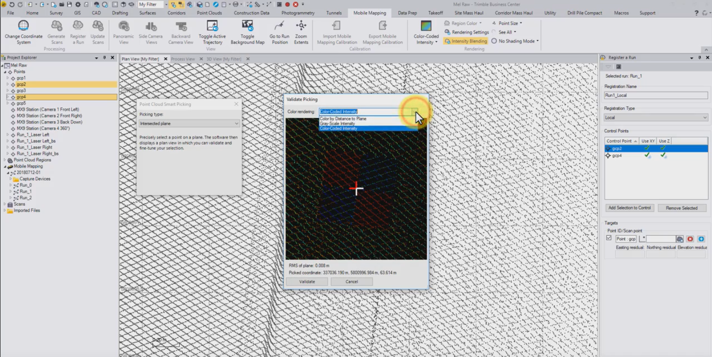
TBC 5.2 features an improved target picking routine that allows selection between scan points which provides:
- best-fit plane created from scan points
- user pick is on plane, not on point cloud
- pick does not snap to point cloud
- higher accuracy of target selection
- uses points from both lasers
You can use in 3D with horizontal or vertical targets, or anything in between. You can also toggle on/off if user wants to snap to point cloud.
MX9 Run-to-Reference Run Registration
This enhancement uses point cloud matching from terrestrial scanning and adjusts the trajectory based on matching result. You can also view residuals and generate a report with them.
The algorithm splits the run in segments of 20 m or 2 seconds, and each section is adjusted to the reference scan by using rigid transformations (same transformations used to adjust terrestrial scans). In-between these sections, these adjustments are interpolated. When you have multiple runs covering the same road again and again, this registration will provide consistent point cloud result.
Split MX9 Run for Registration
Before your scan generation, select a run and pick a point where you want to split. You can get UTC time and distance from start of run from the menu. A split run performs the same as an “unsplit” run, and allows you to focus on one area of a project and process only what is needed.
This document (TBC.v5.20.Release.Notes.pdf ) lists all of the new features available in Trimble Business Center v5.20, along with installation notes, resolved and known issues, system requirements and more.
Trimble Business Center 5.20
Trimble Business Center (TBC) is a geospatial office software that enables users to complete field-to-finish workflows efficiently and with confidence. In a single software package, users can edit, process, and analyze GNSS, total station, level, scanning, terrestrial, and aerial imaging data to achieve the most accurate horizontal and vertical results. Users can also create a variety of deliverables, from 2D topographic plans, to surface and contour maps, to complex alignment/corridor designs.
A quick look at the Trimble Business Center 5.0 (TBC) construction workflow.
About Trimble. Trimble is a leading provider of advanced positioning technology and mobile solutions that maximize productivity and enhance profitability. Positioning-centric information is changing the way people, businesses and governments work throughout the world. By applying Trimble's advanced positioning solutions, productivity increases and safety improvements are being realized.
Product: Trimble Business Center
Version: 5.20
Supported Architectures: x64
Website Home Page : www.trimble.com
Language: english
System Requirements: PC *
Supported Operating Systems: *
Size: 4.2 Gb
System requirements
Operating system:
Microsoft Windows 10 (64-bit version)
Microsoft Windows 8 (64-bit version)
Microsoft Windows 7 (64-bit version with Service Pack 1)
Processor: Dual-core 1.80 GHz or better
recommended: Quad-core 2.80 GHz or better (additional cores with hyper-threading support highly recommended for Aerial Photogrammetry, Mobile Mapping, and Scanning modules)
Random access 4 GB or more recommended
memory (RAM): 32 GB or more recommended for Aerial Photogrammetry, Mobile Mapping, and Scanning modules
Hard disc space available: 10 GB or more recommended 100 GB or more on solid-state drive required for Aerial Photogrammetry, Mobile Mapping, and Scanning modules
The recommended: SSD overall hard drive capacity is 500 GB or more for Aerial Photogrammetry, Mobile Mapping, and Scanning modules
Monitor: 1280 x 1024 or higher resolution with 256 or more colours (at 96 DPI)
I/O Ports: USB 2.0 port required if HASP hardware key is used
Graphics: DirectX 11 compatible graphics card
with 512 MB memory or more
OpenGL version 3.2 or later required when working with point cloud data (latest version recommended)
8 GB graphics card or higher (for example, NVIDIA Quadro P4000) required when working with Aerial Photogrammetry, Mobile Mapping, and Scanning modules
Please visit my blog
Added by 3% of the overall size of the archive of information for the restoration
No mirrors please

![Trimble Business Center 5.20]()
Added by 3% of the overall size of the archive of information for the restoration
No mirrors please
Trimble Business Center 5.20
