

Surfer 16 : Mastering Numeric Cartography
Surfer 16 : Mastering Numeric Cartography
Published 8/2022
MP4 | Video: h264, 1280x720 | Audio: AAC, 44.1 KHz
Language: English | Size: 933.38 MB | Duration: 1h 37m
Published 8/2022
MP4 | Video: h264, 1280x720 | Audio: AAC, 44.1 KHz
Language: English | Size: 933.38 MB | Duration: 1h 37m
From XYZ Excel file to Mapping, 3D and Layout
What you'll learn
Discover the work environment and graphic interface
Importing XYZ Excel file and do statistical operation
Interpolating Data (Gridding Data)
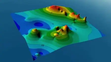
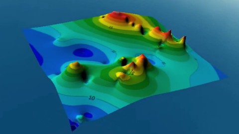
create various types of maps (sampling, topographic, geochemical, 3D)
Georeferencing and digitize a map
Convert coordinates to UTM or Decimal degree
Define the projection system
Overlay maps and layout
Requirements
You should install by your one Surfer 16 software
Have a computer or a Mac
Be connected on internet
Description
Would you like to master Surfer, the simplest GIS software, easy to learn but with fantastic results?How about acquiring that good skill in digital cartography?Represent geospatial data, easily create maps, georeferencing old maps and digitize themSo what you are about to read will interest you.Most GIS software is not easy to learn, it requires long training times while sometimes we only need a map to make our interpretations or represent our data.To avoid getting bored with these laborious manipulations of GIS software, many people have had to hire geomaticians.What was not comforting for their economy and sometimes the expected result is not always satisfactory.If you want to avoid these kinds of problems then Surfer is the GIS software that I advise you to learn.The problem is that there is almost no easiest and complete duly constituted Surfer training on the web.This is why we have created this archi-complete training for you. You will gain the most skills in GIS, from map creation, to geospatial data representation, analysis and layout.In addition, we provide you with practical files in this course to reproduce our lessons at home. And our training is divided into several lessons which explains the Surfer software step by stepSo don't hesitate, register now.
Overview
Section 1: Introduction
Lecture 1 Importing XYZ Excel file and do statistical operations
Lecture 2 Interpolating Data (Gridding Data)
Lecture 3 Sampling
Section 2: Mapping
Lecture 4 Topographic map
Lecture 5 Geochemical map and oveylaying maps
Lecture 6 Reverse a map
Lecture 7 Layout
Lecture 8 3D map
Section 3: Georeferencing, Digitizing and coordinate transformations
Lecture 9 Georeferencing
Lecture 10 Digitizing
Lecture 11 Transform coordinates
Geologist,Mining engineer,Geomatician,Geoscience,GIS