Tags
Language
Tags
July 2025
Su Mo Tu We Th Fr Sa
29 30 1 2 3 4 5
6 7 8 9 10 11 12
13 14 15 16 17 18 19
20 21 22 23 24 25 26
27 28 29 30 31 1 2
    Attention❗ To save your time, in order to download anything on this site, you must be registered 👉 HERE. If you do not have a registration yet, it is better to do it right away. ✌

    ( • )( • ) ( ͡⚆ ͜ʖ ͡⚆ ) (‿ˠ‿)
    SpicyMags.xyz

    Netcad GIS 2024 (8.5.5.1077)

    Posted By: scutter
    Netcad GIS 2024 (8.5.5.1077)

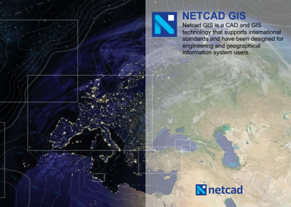
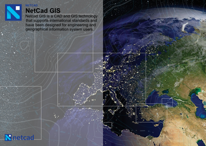
    Netcad GIS 2024 (8.5.5.1077) | 1.4 Gb

    The Netcad development team is pleased to announce the availability of Netcad GIS 2024 (8.5.5.1077) is a geographic data source that supports a wide range of spatial information sources in international standards.

    Orbit 3DM Feature Extraction CONNECT Edition V22 Update 10

    Posted By: scutter
    Orbit 3DM Feature Extraction CONNECT Edition V22 Update 10

    Orbit 3DM Feature Extraction CONNECT Edition V22 Update 10 | 607.4 mb

    Orbit, now part of Bentley Systems, is pleased to announce the availability of Orbit 3DM Feature Extraction CONNECT Edition V22 Update 10 (22.10.00.03). This software enables you to complete simple and complex measurements, auto-extract features, and perform advanced analysis using massive amounts of point cloud, imagery, textured mesh, and traditional GIS resources.

    Orbit 3DM Content Manager CONNECT Edition V22 Update 10

    Posted By: scutter
    Orbit 3DM Content Manager CONNECT Edition V22 Update 10

    Orbit 3DM Content Manager CONNECT Edition V22 Update 10 | 607.6 mb

    Orbit, now part of Bentley Systems, is pleased to announce the availability of Orbit 3DM Content Manager CONNECT Edition V22 Update 10 (22.10.00.03). This software enables data acquisition experts to easily optimize and manage massive amounts of imagery, point cloud, and 3D mapping data from a variety of sources, post-reality capture and before production and sharing with key stakeholders.

    Netcad GIS 2023 (8.5.2.1027)

    Posted By: scutter
    Netcad GIS 2023 (8.5.2.1027)

    Netcad GIS 2023 (8.5.2.1027) | 1.5 Gb

    The Netcad development team is pleased to announce the availability of Netcad GIS 2023 (8.5.2.1027) is a geographic data source that supports a wide range of spatial information sources in international standards.

    Hexagon GeoMedia Suite 2022 (16.7.0.210)

    Posted By: scutter
    Hexagon GeoMedia Suite 2022 (16.7.0.210)

    Hexagon GeoMedia Suite 2022 (16.7.0.210) | 4.7 Gb

    Hexagon’s Safety, Infrastructure & Geospatial division announced the launch of GeoMedia Suite 2022 (16.7.0.210) is a powerful, flexible GIS management platform that lets you aggregate data from a variety of sources and analyze them in unison to extract clear, actionable information.

    ESRI ArcGIS Pro 3.0 patch 1 (3.0.1) with Content

    Posted By: scutter
    ESRI ArcGIS Pro 3.0 patch 1 (3.0.1) with Content

    ESRI ArcGIS Pro 3.0 patch 1 (3.0.1) with Content | 12.5 Gb

    Esri, the global leader in spatial analytics technology, is pleased to announce the availability of ArcGIS Pro 3.0 patch 1 (3.0.1). This update is primarily a quality improvement release, and bug fixes that improve the 3.0 release.

    PCI Geomatica Banff 2020 SP2

    Posted By: scutter
    PCI Geomatica Banff 2020 SP2

    PCI Geomatica Banff 2020 SP2 | 1.1 Gb

    PCI Geomatics, a world-leading developer of remote sensing and photogrammetry software, announced the release of new features and enhancements in Geomatica Banff 2020 SP2.

    Trimble Inpho UASMaster 12.1.1 with Sample Data Sets

    Posted By: scutter
    Trimble Inpho UASMaster 12.1.1 with Sample Data Sets

    Trimble Inpho UASMaster 12.1.1 with Sample Data Sets | 3.9 Gb

    The Trimble Geospatial development team is pleased to announce the availability of Inpho UASMaster 12.1.1 is combines ease of use with the full power of a photogrammetric workstation and bridges the gap between simple near black-box workflows for non-photogrammetrists and photogrammetry expert workflows.

    OpenCities Map Ultimate CONNECT Edition Update 17

    Posted By: scutter
    OpenCities Map Ultimate CONNECT Edition Update 17

    OpenCities Map Ultimate CONNECT Edition Update 17 | 7.4 Gb

    The software developer OpenCities Map is pleased to announce the availability of OpenCities Map Ultimate CONNECT Edition Update 17 (10.17.00.156) is a full-featured GIS designed to address the unique and challenging needs of organizations that map, plan, design, build, and operate the world's infrastructure.

    OpenCities Map Advanced CONNECT Edition Update 17

    Posted By: scutter
    OpenCities Map Advanced CONNECT Edition Update 17

    OpenCities Map Advanced CONNECT Edition Update 17 | 2.9 Gb

    The software developer OpenCities Map is pleased to announce the availability of OpenCities Map Advanced CONNECT Edition Update 17 (10.17.00.156) is a full-featured GIS designed to address the unique and challenging needs of organizations that map, plan, design, build, and operate the world's infrastructure.

    Blue Marble Global Mapper Pro 23.1.0

    Posted By: scutter
    Blue Marble Global Mapper Pro 23.1.0

    Blue Marble Global Mapper Pro 23.1.0 | 359.4 mb

    Blue Marble Geographics is pleased to announce the immediate availability of Global Mapper 23.1.0 build 021522. Equally well suited as a standalone spatial data management tool and as an integral component of an enterprise-wide GIS, Global Mapper is a must-have for anyone who works with maps or spatial data.

    OpenFlows SewerGEMS CONNECT Edition Update 3.4

    Posted By: scutter
    OpenFlows SewerGEMS CONNECT Edition Update 3.4

    OpenFlows SewerGEMS CONNECT Edition Update 3.4 | 1.4 Gb

    The Hydraulics and Hydrology products team is pleased to announce the availability of SewerGEMS CONNECT Edition Update 3 (10.03.04.53). This release includes enhancements and new features to help you be more successful with your hydraulics and hydrology modeling projects.

    OpenFlows Hammer CONNECT Editon Update 3.4

    Posted By: scutter
    OpenFlows Hammer CONNECT Editon Update 3.4

    OpenFlows Hammer CONNECT Editon Update 3.4 | 1.4 Gb

    The Hydraulics and Hydrology software development team are pleased to announce the availability of OpenFlows HAMMER CONNECT Edition Update 3.4 (10.03.04.05). This update introduces improvements and features to help you be more successful.

    OpenCities Map Advanced CONNECT Edition Update 16

    Posted By: scutter
    OpenCities Map Advanced CONNECT Edition Update 16

    OpenCities Map Advanced CONNECT Edition Update 16 | 3.7 Gb

    The software developer OpenCities Map is pleased to announce the availability of OpenCities Map Advanced CONNECT Edition Update 16 (10.16.00.60) is a full-featured GIS designed to address the unique and challenging needs of organizations that map, plan, design, build, and operate the world's infrastructure.

    Exelis ENVI 5.3.1

    Posted By: scutter
    Exelis ENVI 5.3.1

    Exelis ENVI 5.3.1 | 2.7 Gb

    The Harris Geospatial Solutions, Inc , develops products for the visualization, analysis, and management of geospatial imagery and scientific data, has unveiled ENVI 5.3.1. This update packed full of new features and functionality that will help you do more with your geospatial data than ever before.