

Development Of Et Sebal Model In Google Earth Engine

Development Of Et Sebal Model In Google Earth Engine
Published 6/2023
MP4 | Video: h264, 1280x720 | Audio: AAC, 44.1 KHz
Language: English | Size: 6.02 GB | Duration: 10h 42m
Published 6/2023
MP4 | Video: h264, 1280x720 | Audio: AAC, 44.1 KHz
Language: English | Size: 6.02 GB | Duration: 10h 42m
Step by step guide for croplands
What you'll learn
SEBAL
Evapotranspiration
Google Earth Engine
Remote Sensing
NDVI, SAVI, LAI
Surface Temperature
Incoming Longwave Radiation
Incoming Shortwave Radiation
Surface Emissivity
Momentum Roughness Length
Sensible Heat Flux
Soil Heat Flux
Outgoing longwave radiation
Net radiation flux
Requirements
Basic (or better Intermediate) knowledge of Google Earth Engine
Good Internet Connection
Description
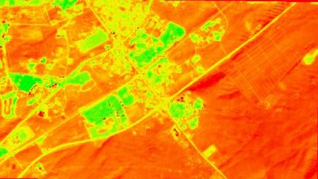
In this course, you will master a step-by-step guide to developing a script in Google Earth Engine for the most famous Evapotranspiration model - Surface Energy Balance Algorithm for Land (SEBAL) for agricultural areas. Before starting a course, please read the requirements for the course - you need to have a Google Earth Engine profile (free to open), and a basic or better intermediate level of scripting in GEE or JavaScript. As a research study area an agricultural field that is located in Dubai Emirate, the UAE was taken. You can apply this course to your study area by making minor changes. It is good if you also have some knowledge/ experience of evapotranspiration. The course is divided into a theoretical part and a practical part, the latter of which constitutes almost 90 % of the course. Each practical part of the course contains an attached script in txt format. After finishing the course, besides developing the SEBAL model, you can apply different parts of the course in your other projects, that involve remote sensing. The course also contains two QGIS plugins ( to calculate instantaneous reference evapotranspiration and correlation coefficients) developed deliberately for the course which is free to download. Get ready to boost your knowledge in remote sensing and Google Earth Engine!
Overview
Section 1: Introduction
Lecture 1 Introduction
Lecture 2 Manual
Section 2: Fundamental theory
Lecture 3 Evapotranspiration
Lecture 4 Surface energy balance
Lecture 5 SEBAL model
Lecture 6 Net radiation flux (Rn)
Lecture 7 Soil heat flux(G)
Lecture 8 Sensible heat flux(H)
Lecture 9 Cold and Hot anchor pixels
Lecture 10 Air density
Section 3: Before starting the script
Lecture 11 Image Collections of GEE that will be used
Lecture 12 Necessary functions that will be used.Part 1
Lecture 13 Necessary functions that will be used.Part 2
Section 4: Net Radiation Flux (Rn)
Lecture 14 Starting the project in GEE
Lecture 15 Adding Landsat 8 Image collection
Lecture 16 Dataset subdivided by path and row
Lecture 17 Creating newDataset function
Lecture 18 Starting newDataset, defining parameters, defining geometry
Lecture 19 Computation of spectral radiance for each band
Lecture 20 Inverse squared relative earth sun distance
Lecture 21 Computation of reflectivity for each band
Lecture 22 Top of the atmopshere albedo
Lecture 23 Surface albedo
Lecture 24 Incoming shortwave radiation
Lecture 25 Outgoing longwave radiation - NDVI, SAVI, LAI
Lecture 26 Surface emissivity
Lecture 27 Surface temperature
Lecture 28 Outgoing longwave radiation
Lecture 29 Finishing newDataset
Lecture 30 Correcting the errors
Lecture 31 Image bounds for image path and row
Lecture 32 Chosing cold and hot pixels
Lecture 33 Importing the location of a cold pixel for incoming longwave radiation
Lecture 34 Incoming Longwave Radiation
Lecture 35 Creating newDataset2
Lecture 36 Computing Rn
Lecture 37 Adding a geometry
Lecture 38 Test Rn
Lecture 39 All images with computed bands and dates
Lecture 40 Export to drive and assets
Lecture 41 Discovering Rn image in ArcGIS or QGIS
Section 5: Momentum roughness length (z)
Lecture 42 Copernicus land cover classes areas
Lecture 43 Momentum roughness length for the study area
Lecture 44 Sampling
Lecture 45 Pixel count and export
Lecture 46 Correcting Zom -import of LAI
Lecture 47 Correcting zom for agricultural fields with LAI values
Section 6: Soil Heat Flux (G)
Lecture 48 Importing our hot and cold pixels
Lecture 49 Visualization parameters
Lecture 50 Defining bands to be sampled
Lecture 51 Add layers to corraborate where cold and hot pixels are
Lecture 52 Function for G and Rn ratio
Lecture 53 Soil heat flux (G) and Rn and G ratio computation
Lecture 54 Adding layers
Lecture 55 Sampling bands for hot and cold pixels
Lecture 56 Basic undertanding of variables for H and their values
Lecture 57 Momentum roughness length for a weather station
Lecture 58 Friction velocity at the weather station
Lecture 59 Wind velocity at 200 meters for a weather station
Lecture 60 Air density for hot and cold pixels
Lecture 61 Exporting data in CSV format
Section 7: Sensible Heat Flux (H)
Lecture 62 Theory of Iteration processs of H
Lecture 63 The weather data we need for Etr
Lecture 64 Adding ECMWF Climate Reanalysis collection
Lecture 65 Selecting necessary climate data
Lecture 66 u,v, surface net solar radiation and dewpoint temperature
Lecture 67 Conversion to Feature Collection from Image Collection
Lecture 68 Weather station elevation and export climate data
Lecture 69 Calculation of reference evapotranspiration
Lecture 70 Time issues around weather data and ETr
Lecture 71 Developing script for instantenous wind and ETr. Part 1
Lecture 72 Developing script for instantenous wind and ETr. Part 2
Lecture 73 Developing script for instantenous wind and ETr. Part 3
Lecture 74 Instantenous wind speed and ETr in QGIS plugin
Lecture 75 Working with getsebal plugin
Section 8: Finishing the SEBAL model
Lecture 76 Part 1
Lecture 77 Part 2
Lecture 78 Part 3
Lecture 79 Part 4
Section 9: Сhanging the developed script for other images of the year
Lecture 80 Re-computing the momentum roughness length corrected for January 13
Lecture 81 Re-computing the soil heat flux, values for hot and cold pixels and weather d
Lecture 82 Export weather parameters for a new image
Lecture 83 Computation ofr hourly ETr
Lecture 84 Instantenous wind speed and ETr for the new image
Lecture 85 Obtaining Correlation coefficients
Lecture 86 Calculating SEBAL for January 13
Remote sensing specialists,GIS specialists,Remote sensing master students,GIS master students,Hydrologists,Ecologists,Crop scientists,Ecologists,Environmentalists